
Webcams
One picture is worth ten thousand words. A single glance into a hazard zone can supply crucial information to decision makers and experts. Further, high definition images provided with novel cameras, allow for automatic deformation analysis of the monitored area. Geopraevent installs and operates webcams in high-mountain environments and uses GPRS-, radio- or tethered data transmissions to our data portal in order to let you access your data at all times.
Advantages
- View into the hazard zone at any time of day
- On demand real-time images
- High-definition pictures of up to 40 megapixels
- Automatic deformation analysis over defined period of time
- Autonomous image selection by system
- Access to image archive through the online data portal
- Data transmission to Geopraevent servers by radio, GPRS, or cable connection
- Standalone power supply
- Robust construction to withstand harsh alpine environments
- User-friendly online functionalities like charts with integrated image view
Applications
In critical situations, a good view of a hazard area can be crucial. Webcams are useful in a wide variety of applications, such as a stand-alone tool for a monitoring system (e.g. deformation analysis) or as extension to an alarm or warning systems. We employ high resolution cameras that offer up to 40 megapixels allowing to identify even small details within the monitored area. Selection and analysis of the qualified images is carried out automatically and over a defined period of time.
Some examples of projects that use webcams are:
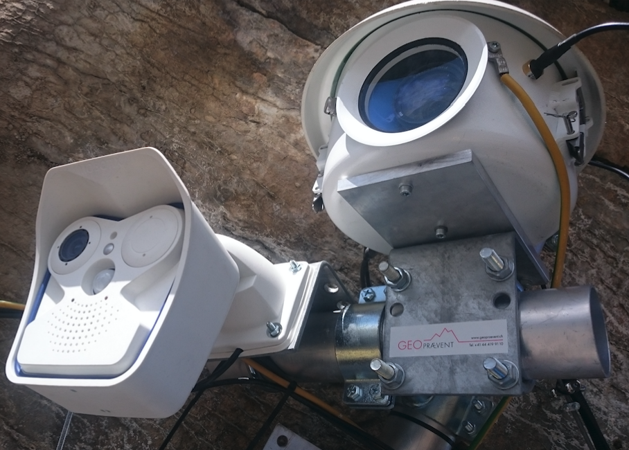
Two different cameras monitor the Giétro glacier in Switzerland: standard Mobotix webcam and high resolution DSLR in protective casing.
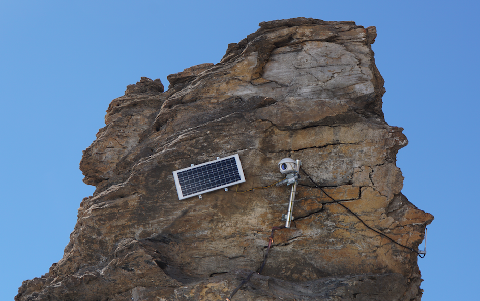
Cameras can be mounted in harsh environments and powered by solar panels.
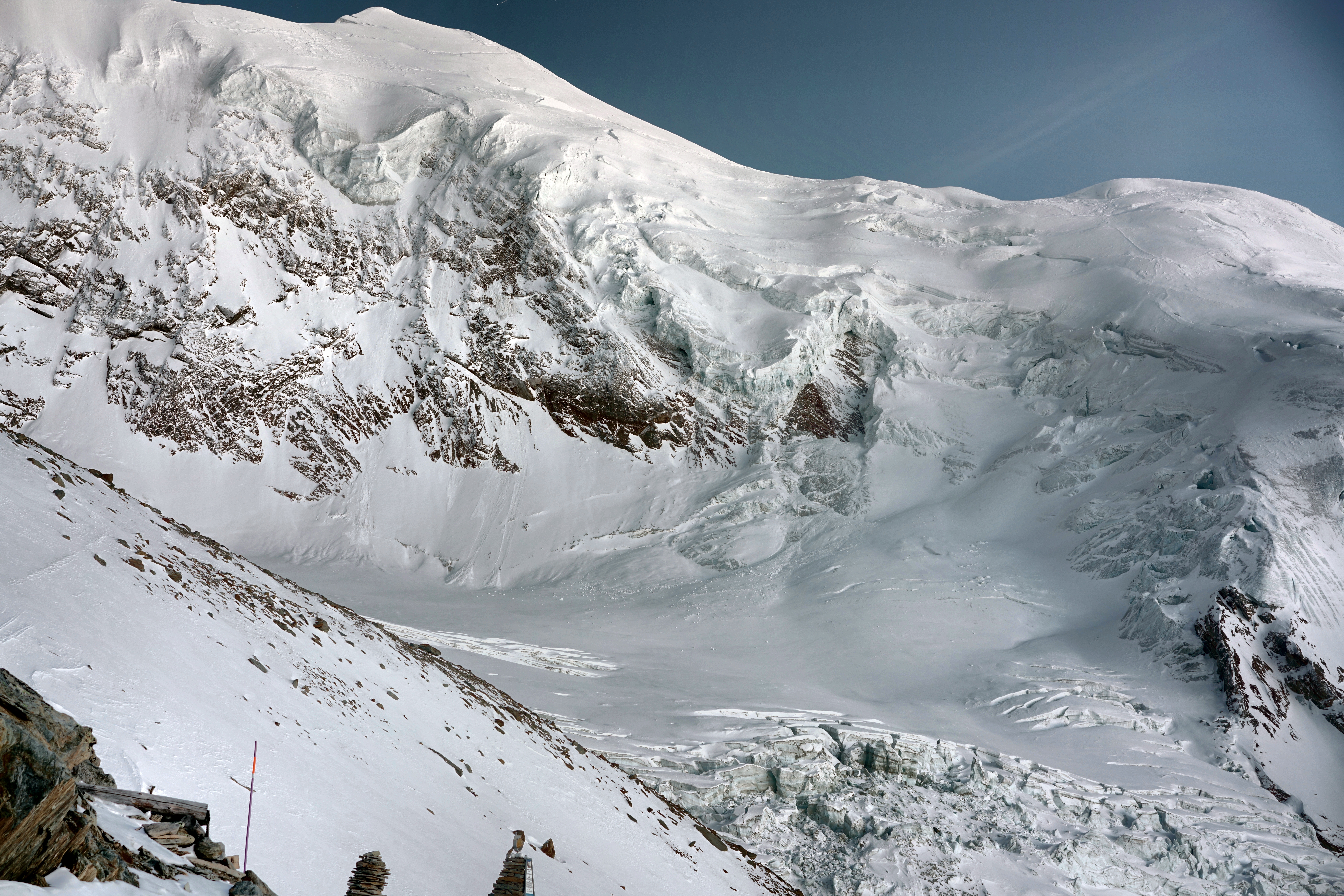
The novel high-definition camera provides pictures with remarkable detail of a large area even from great distance.

Deformation analysis is carried out automatically with selected pictures by the system and over a defined period of time.
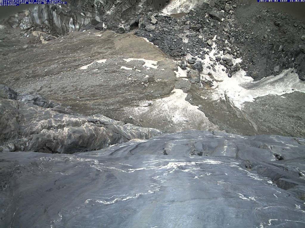
View of the entrance to the flood relief tunnel at Grindelwald glacier.
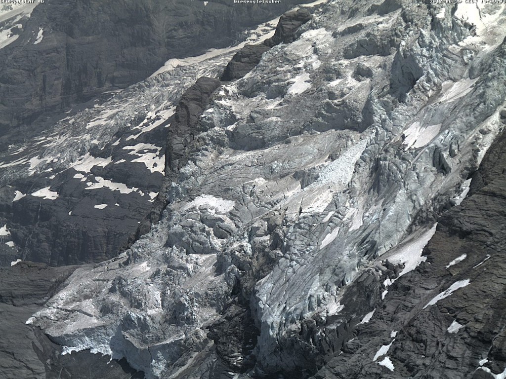
The steep and heavily crevassed terminus of the Giesen glacier.
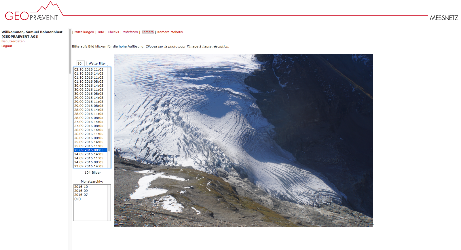
Image of the Giétro glacier captured by the high resolution camera and displayed in the online data portal…
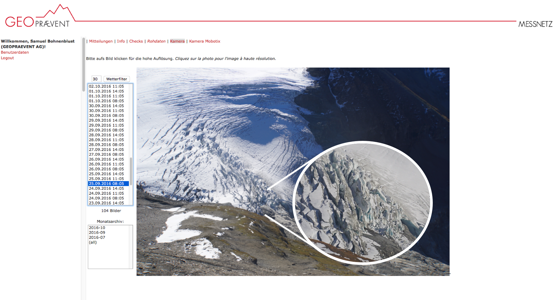
… allowing users to see in great detail what the situation is like.

Kelequin River, China. Here, a webcam and a gauging station transmit images and flow level measurements to our servers via satellite.
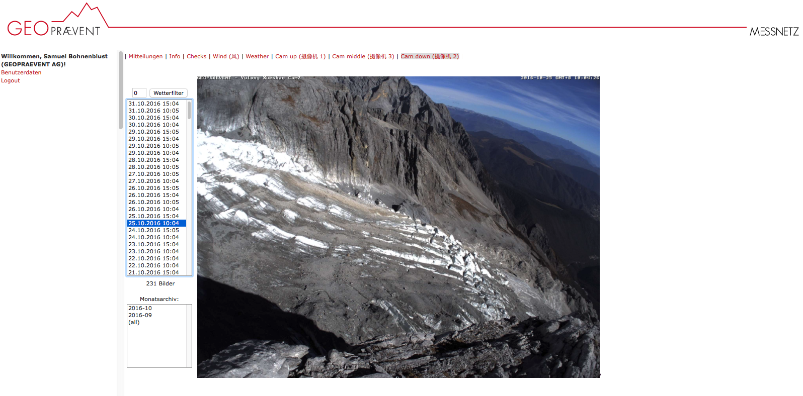
Image of the Yulong Glacier accessible through the online data portal.
Additional technologies
Webcams are often used in combination with: