
Monitoring Kleines Nesthorn, Lötschental
Situation
One year ago, on May 28, 2025, a series of processes led to the burial of the village of Blatten in the Lötschental valley (Canton of Valais, Switzerland). The event was triggered by the collapse of part of the Kleines Nesthorn, which fell onto the Birch Glacier. As a result, the glacier collapsed under the pressure of the deposited material as well as increasing meltwater at its base. This led to a rock-ice avalanche that advanced into the valley and buried a large part of the village of Blatten.
Since the village had already been evacuated on May 19, 2025, there was fortunately only one fatality. Nevertheless, the village was largely destroyed: 130 houses were buried, and additional ones were later flooded due to the damming of the Lonza river.
The early evacuation was possible in part due the failure being preceded by progressive precursors, which were detected and monitored through an array of systems, working in parallel to provide meaningful data to support critical decision-making processes.
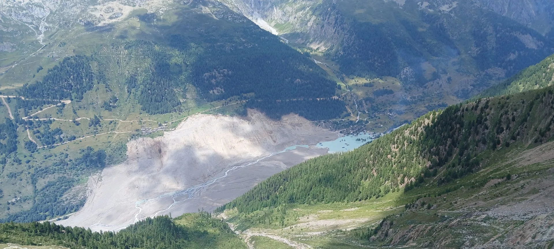
The village of Blatten under the deposited material after the Glacier collapse on May 28th, 2025.
Solution
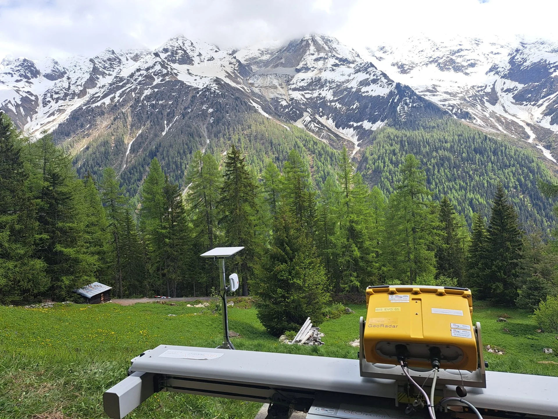
The deployed interferometric radar, with an energy self-sufficient power supply and satellite data transmission. In the background, the lower part of the Birch Glacier is visible.
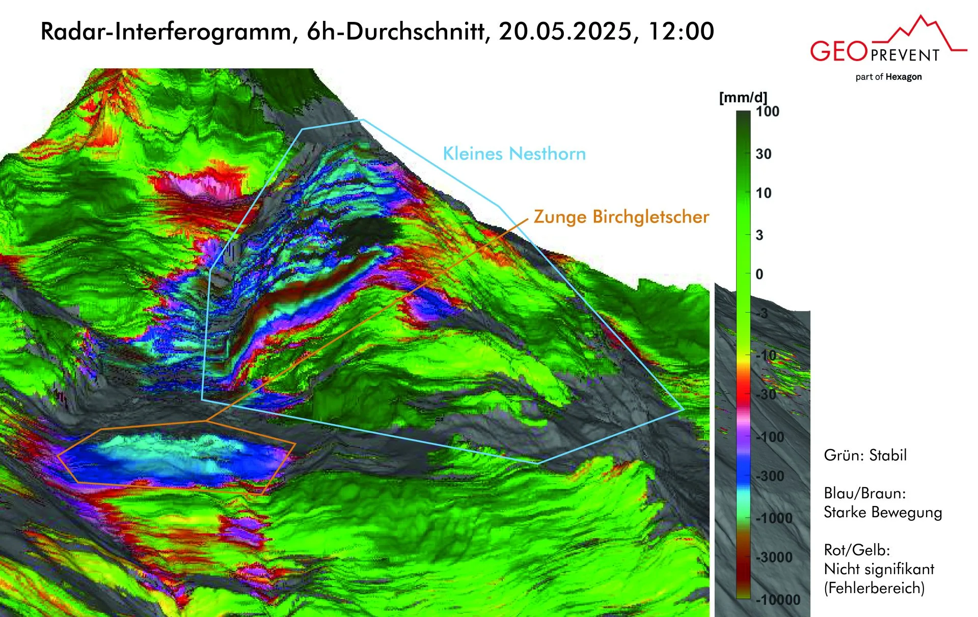
The displacement velocity measured by the interferometric radar.
The operation of the radar proved to be challenging on the data transmission side as the media presence in the valley ate restrained the available band for data transmission, as about 1 GB of day had to be uploaded to the cloud for the analysis. The local provider set up a prioritized access for this system, which solved the problem. As a back-up, a broadband satellite link was installed. These data helped authorities and experts manage and evaluate the situation as it progressed. Through assessing phase changes of the reflected signal between repeat scans, small movements could be observed of the monitored region which could occur independently of rain, snow, fog or darkness at distances of 4 km with the maximum monitored area being up to 5 km².
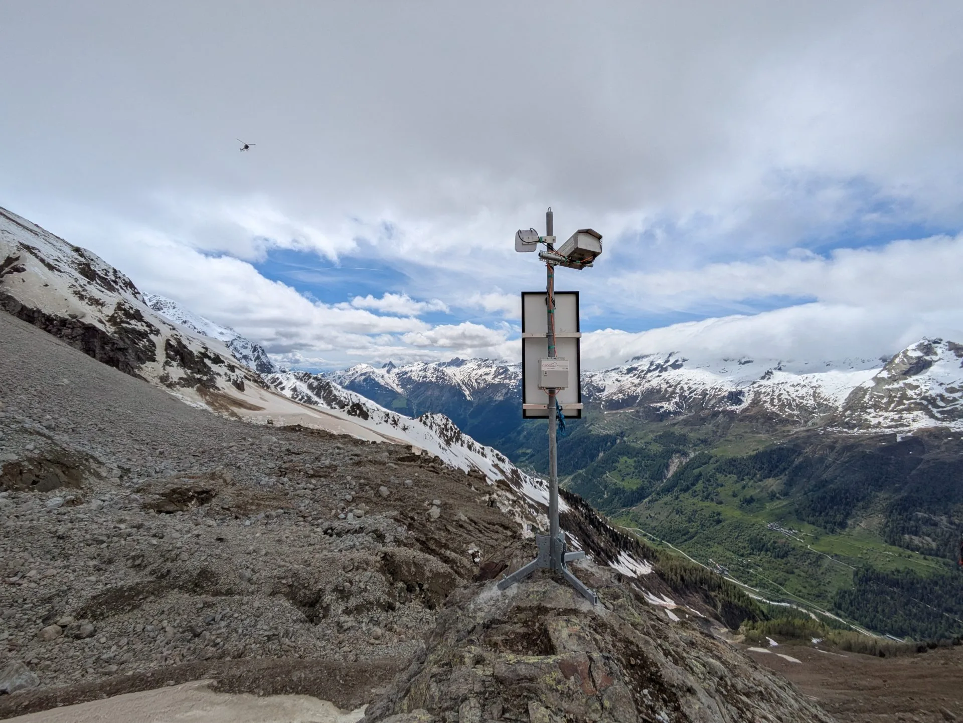
PROCam camera system on the Eastern moraine of the Birch glacier on the day before the rock avalanche.
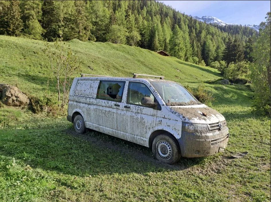
Der Bus von GEOPREVENT konnte während der Installation der Kamera wegen der Evakuierung von Blatten nicht mehr aus der Gefahrenzone gefahren werden. Deshalb wurde er auf der gegenüberliegenden Hangseite abgestellt. Durch die Druckwelle des Ereignisses wurden die Scheiben teilweise zerstört.
To address the long-term recovery efforts, the installation has changed from an emergency, short-term rapid deployment to a mid-to long-term monitoring project. This will provide additional safety for the debris removal and construction in Blatten. Further supporting this phase, additional cameras and GPS systems were installed by Geoprevent to provide additional insights into the stability and deformation potential in the vicinity of the Kleines Nesthorn.
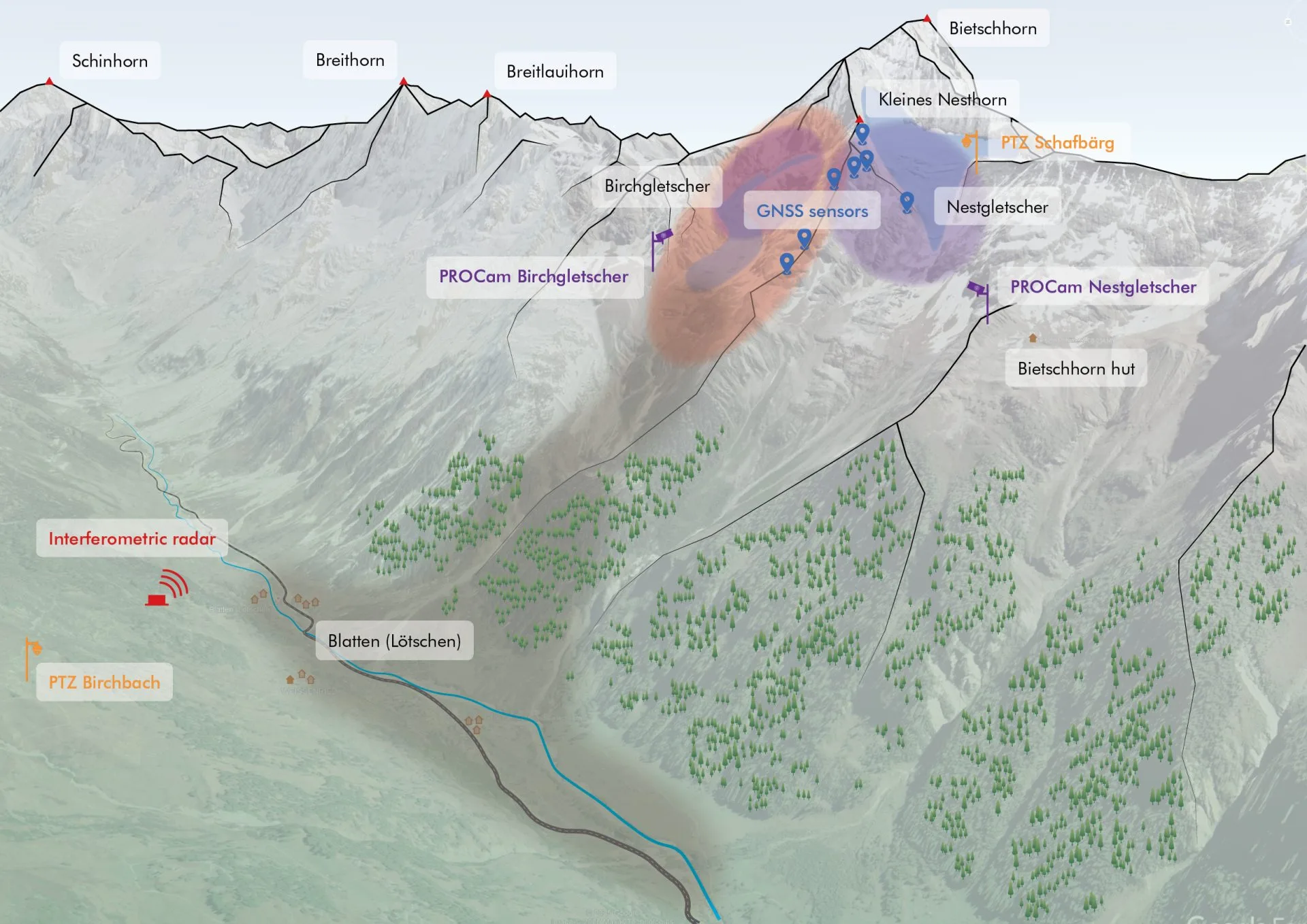
A schematic showing the full deployed system including cameras systems, GNSS sensors, and an interferometric radar.
Customer
Gemeinde Blatten