Monitoring landslide Moosfluh
Challenge
Moosfluh is a large landslide area on the left edge of the Aletsch Glacier, the largest glacier of the European Alps. On the north side of the landslide is the popular ski resort and village of Riederalp. Due to the steady decline of the glacier, the foot of the slope increasingly lacks the stabilizing effect of the glacier ice, causing the slope to start moving. Since the mid-1990s, the unstable slope has glided continuously downwards, leading to deep cracks in the terrain, rockfalls and small landslide events. At times the Moosfluh moved rapidly, for example in autumn 2016 with up to 80 cm/day. In the following year, the slide velocity rate slowed down again. However, geologists expect further accelerations.
The Moosfluh slide area extends over approx. 1 km² and has a volume of at least 150 million m³. Spontaneous small landslides and collapses are possible at any time, which is why all hiking trails in the area were permanently closed in 2016.
Solution
Optical deformation analysis with our high-resolution camera is an ideal and cost-efficient solution for the long-term monitoring of landslides, such as the Moosfluh. The deformation camera is installed on the opposite slope of the landslide and captures the landslide area several times a day. The system uploads the images to the Geopraevent servers to evaluate the surface deformation. Our algorithms automatically compare the images and calculate the displacements of small image fields over a desired time window.
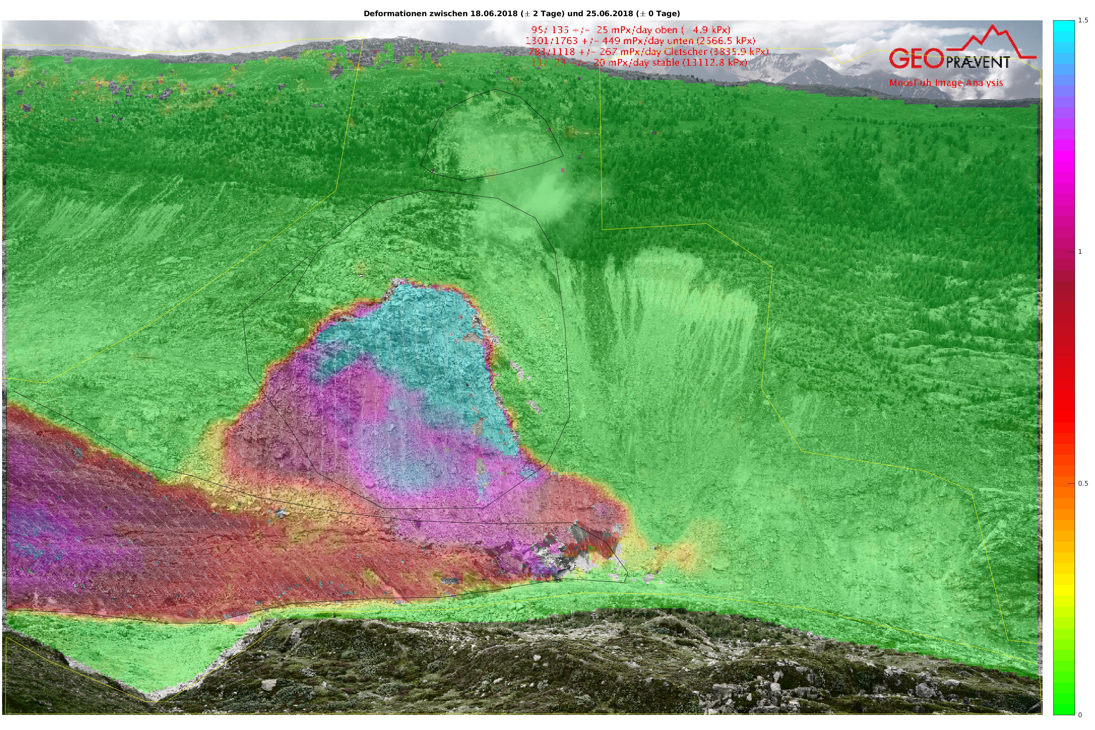
Example of a deformation analysis from June 26, 2018: Of particular interest are the two black bordered areas on the slope; we therefore calculate the velocities for several defined points and display the time series in the data portal.
Automatic deformation analysis requires the system to independently find suitable images for comparison. We apply a proprietary algorithm to select the optimum imagery considering the frequently changing visibility conditions and light/shadow conditions. The time interval of the analysis is flexible. Image processing is automated and involves complex calculations (generally during the night). The evaluated displacements are then displayed in colour overlaid on the current area picture (or terrain model if desired).
Authorised users can access all deformation analyses and high-resolution images of Moosfluh at any time via the Geopraevent online data portal. Accelerated rock areas can be identified quickly and easily, and interesting areas can be assessed in more detail with the new image viewer; zoom in to view individual stones and track them over an arbitrary period of time.
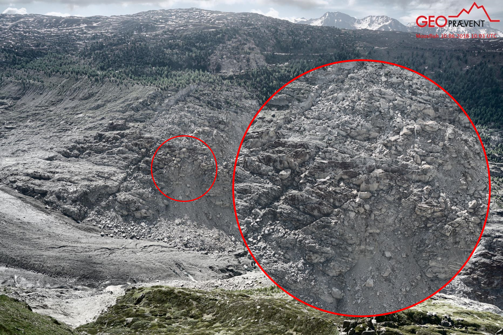
Collapse example April 2018 (6. vs. 7.4.2018)
The deformation camera has been continuously running since summer 2017, even over the snow-rich winter 2017/18. During the winter, deformation analyses were also often possible despite snow cover. The following example shows a collapse in early April with the according deformation analysis indicating the event several days before.
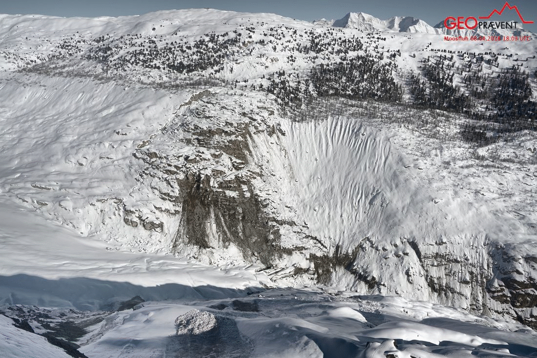
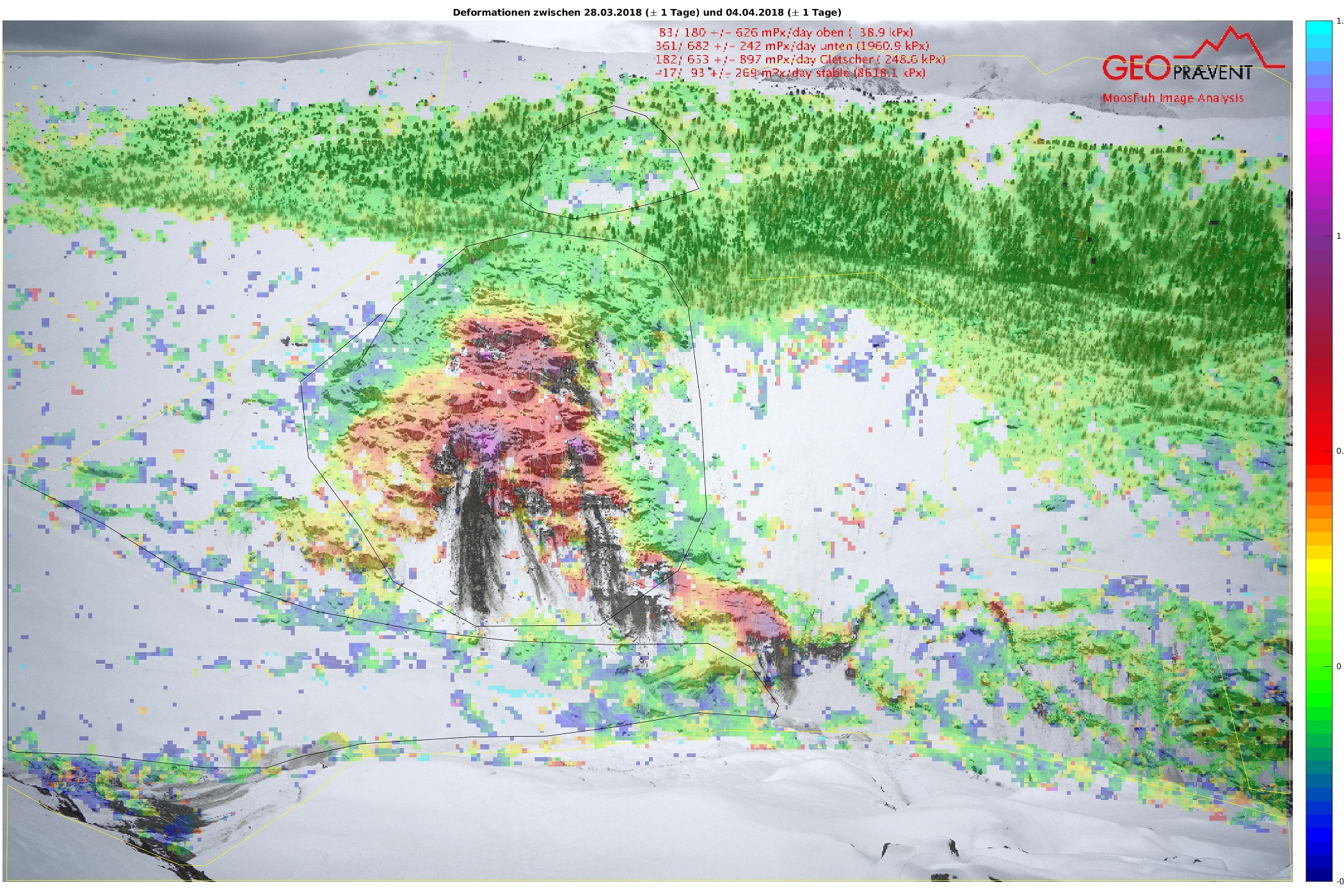
Before/after images (6/7 April 2018) and deformation analysis of 4 April 2018. The (here) dark violet area within the observed area (with black border) accelerated over several days until it finally broke off on 7 April 2018.
More information
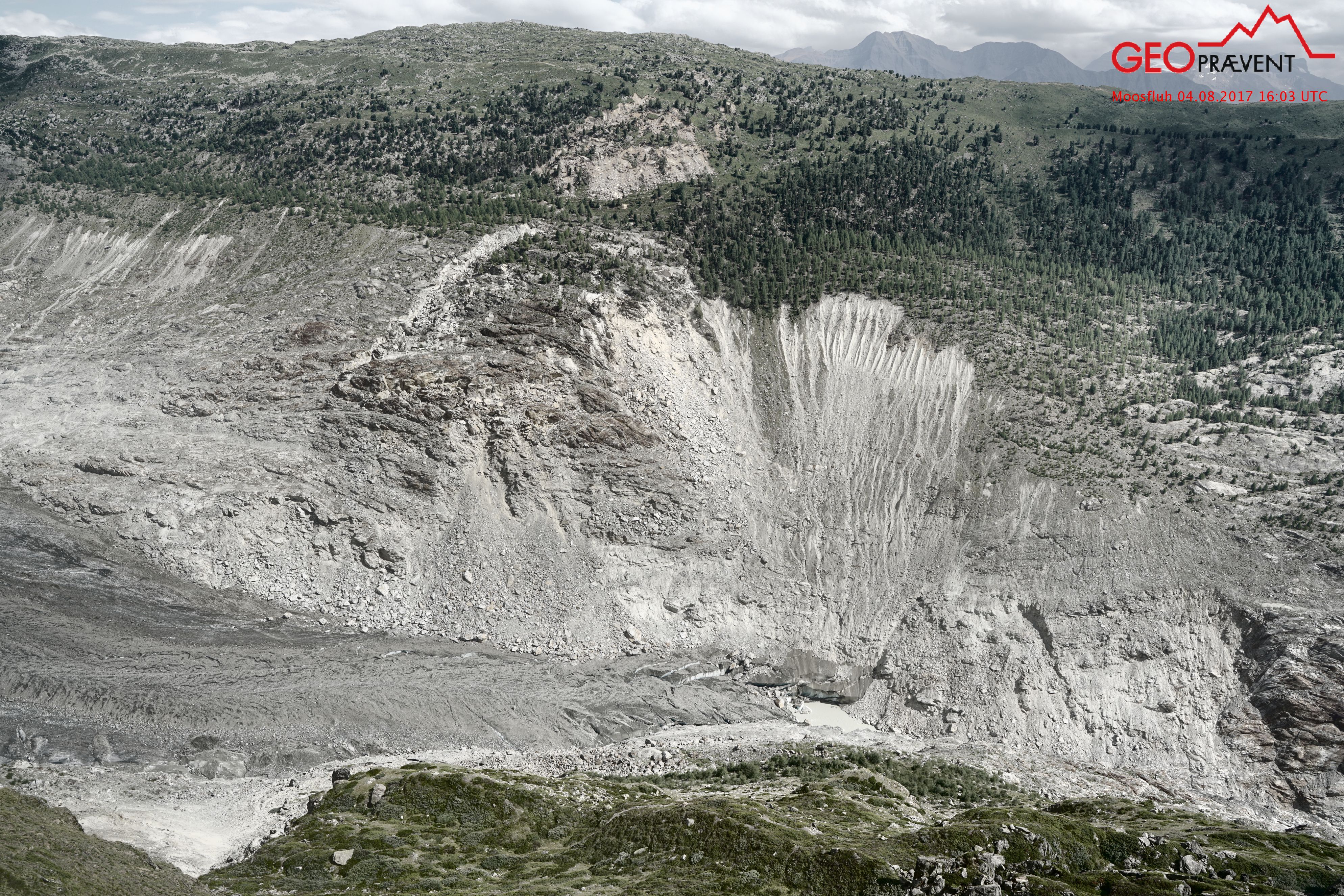
The unstable area above the glacier snout.
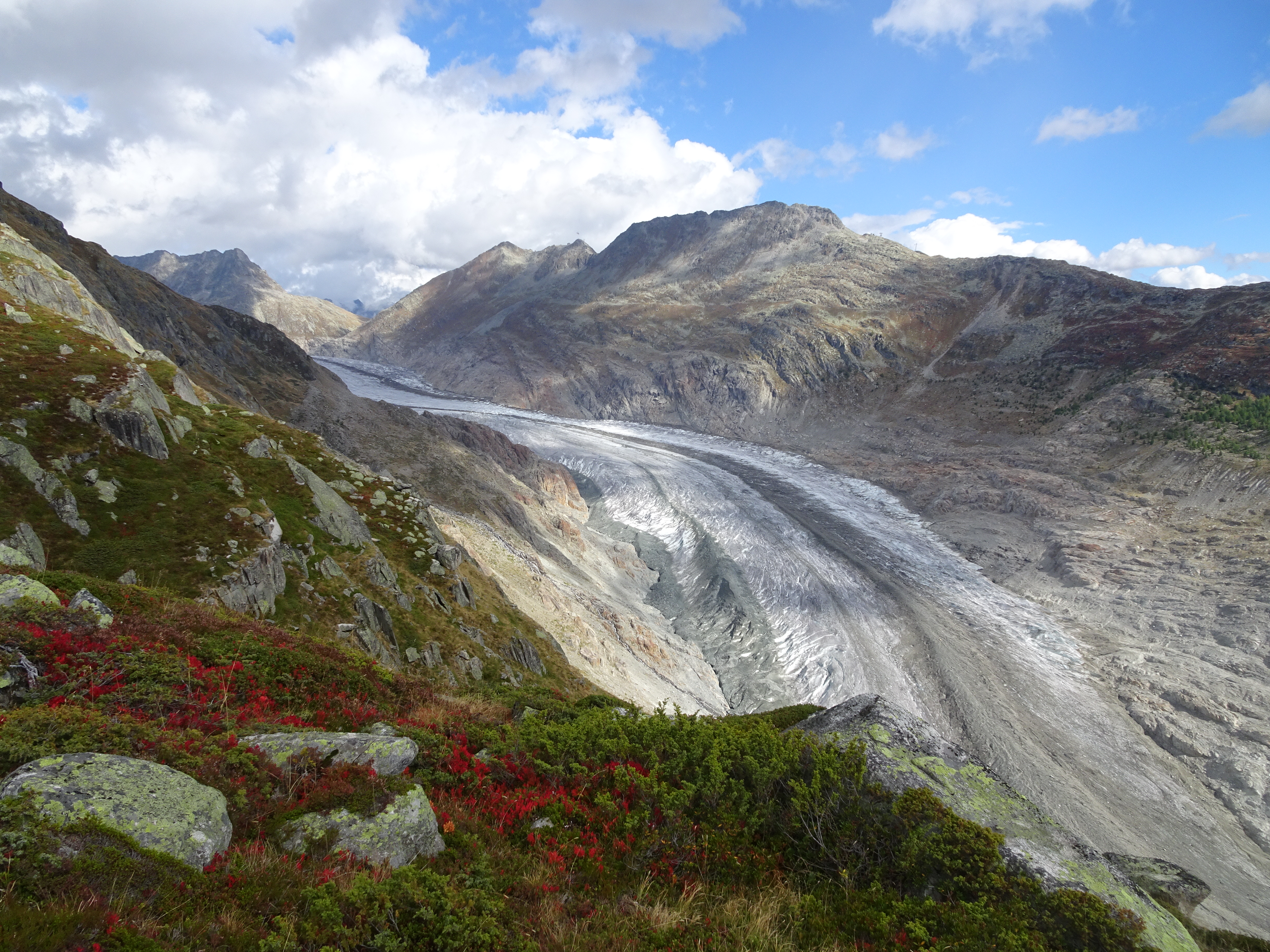
Aletsch Glacier: the largest and longest glacier in the Alps is rapidly retreating.
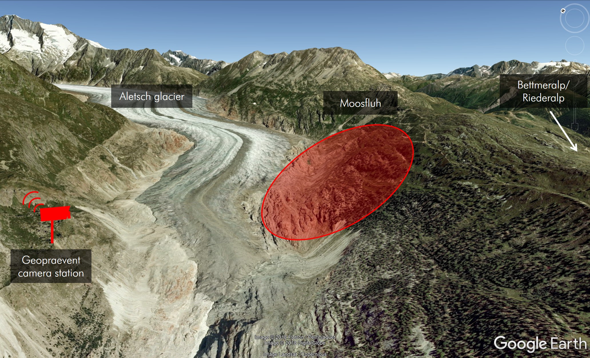
The deformation camera monitors the Moosfluh landslide above Aletsch Glacier from the opposite side.
Deformation analysis of 26 June 2018: Velocities have increased again compared to summer 2017.
Zoom functionality of the online data portal.
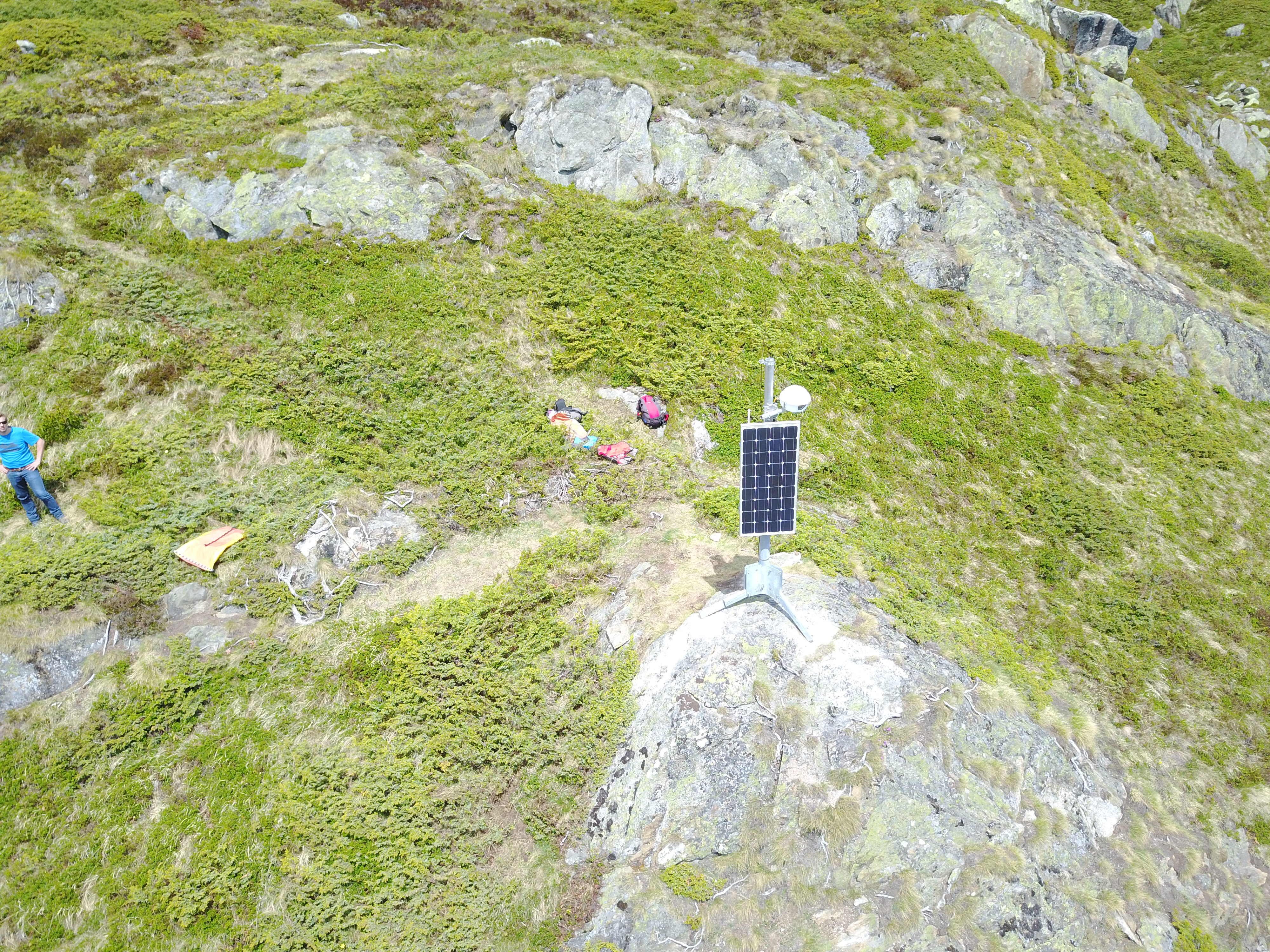
Compact camera station with autonomous power supply.
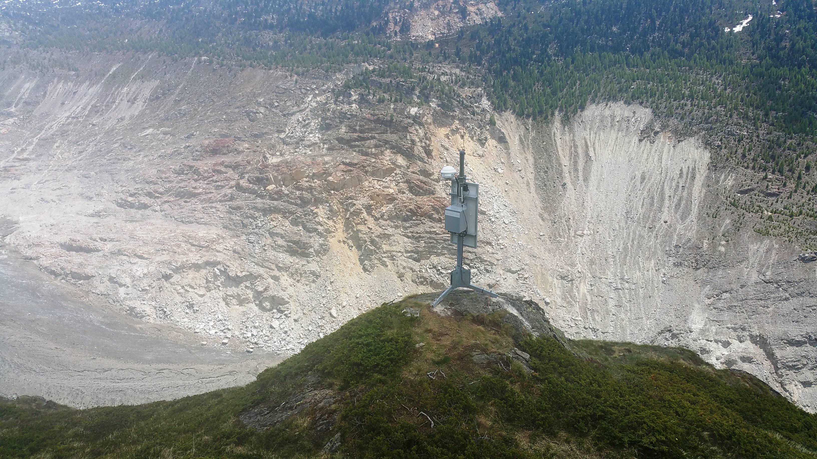
Ideal camera view to the landslide area.
Location
Moosfluh
Customer
Canton of Valais
Technologies
Download