2D radar measurements
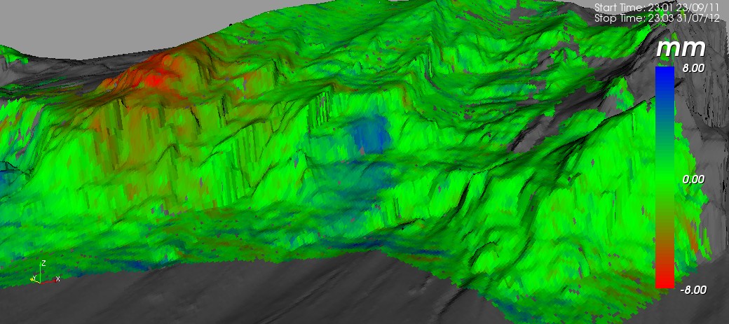
With our interferometric radar, terrain deformations can be localized precisely and movements in the millimeter range can be measured with high spatial resolution. However, the radar can only detect the component of movement along the direction of the radar beam. Therefore, the direction of movement has to be roughly known. Luckily, this question can be answered on the basis of visible cracks and deformations most of the time. The picture below shows an example of such an evaluation. The deformations have been recorded within 10 months. Red means in the direction of the radar, blue away from the radar.
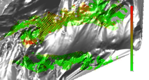
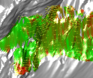
With our newly developed method, it is now also possible to measure movements in two and three dimensions. For the measurement of 2D movements, two locations are necessary and their results are combined into two-dimensional deformation vectors which can be visualizied on a digital terrain model. In the following examples, the color represents the absolute amount of the deformation, the vectors are plotted in yellow. These kind of measurements facilitate the understanding of the geological processes considerably.
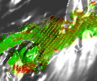
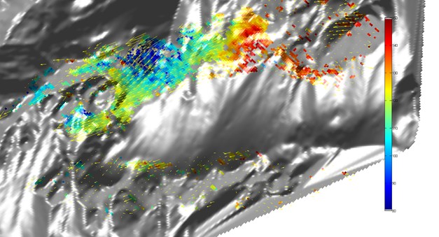
Instead of the amount of deformation, the azimuth of the motion can be visualized, as shown in the second of the following plots.