
Finding the optimal monitoring location
Monitoring moving objects and natural hazards remotely is becoming more and more frequent. Remote sensing technologies make it possible to monitor large areas from a distance and avoid sending people into a hazardous area. Radars – like for example Geopraevent’s Avalanche Radar – are examples of such a technology: They don’t rely on visibility, cover large areas and work at long ranges.
Optimizing Location
Finding the optimal location for sensors is decisive for a successful monitoring system. Just like the human eye, the radar needs a clear view of its target, and can’t see through hills, rocks or buildings. It is therefore imperative that a location be chosen that minimizes shadowing effects and maximizes the area covered.
The Digital Terrain Model (DTM)
At Geopraevent we have developed tools that let us use Digital Terrain Models (DTMs) to find the optimal monitoring location. We start out by marking the Region of Interest (ROI) on the DTM. This could be the unstable area or the avalanche gully that needs to be monitored. From there, all possible sensor locations are back-calculated to indicate what fraction of the ROI is visible from each possible location. In Figure 1, the optimal location is somewhere in the dark red area from which 90% of the ROI are visible. Lastly, we project the visible area from the found location onto the DTM to visualize the sensor’s field of view (Figure 2). This helps to find holes in the coverage and take appropriate measures if necessary.
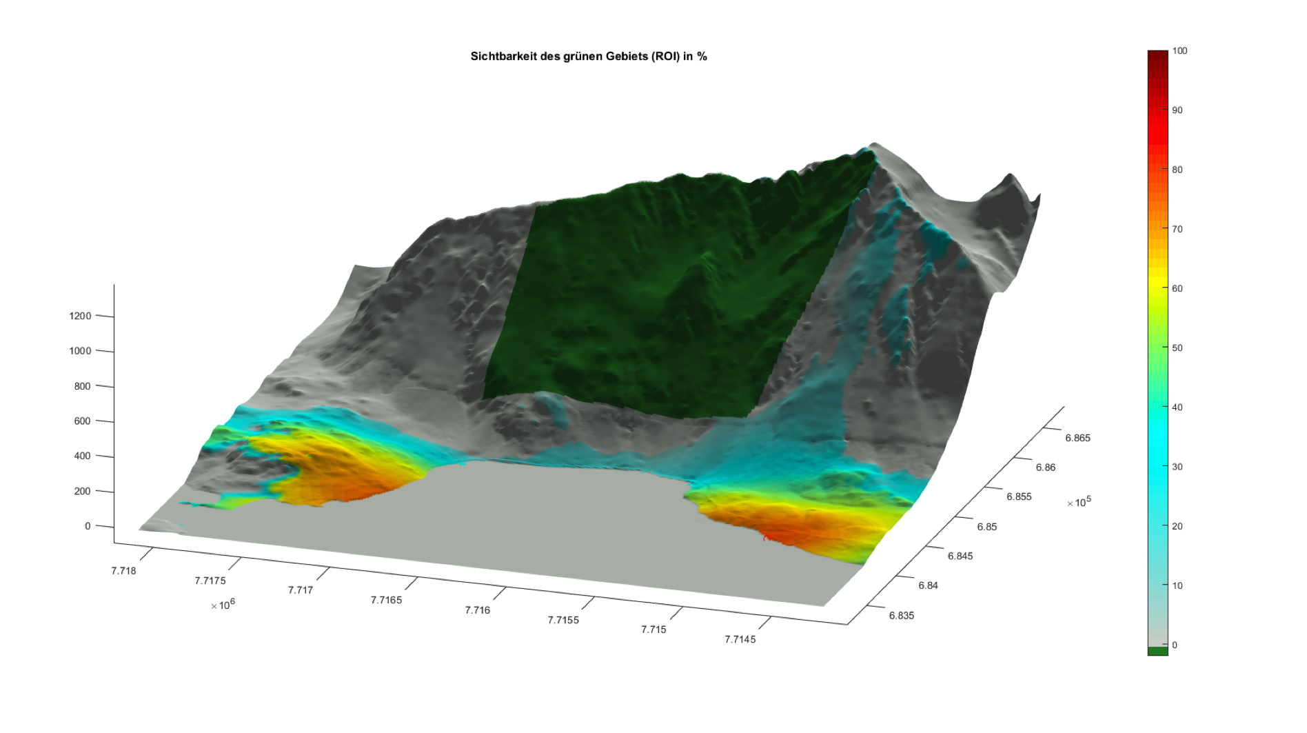
Figure 1: Dark red areas indicate the most suitable sensor locations for the Region of Interest (ROI). Roughly 90% of the ROI are visible from this location.
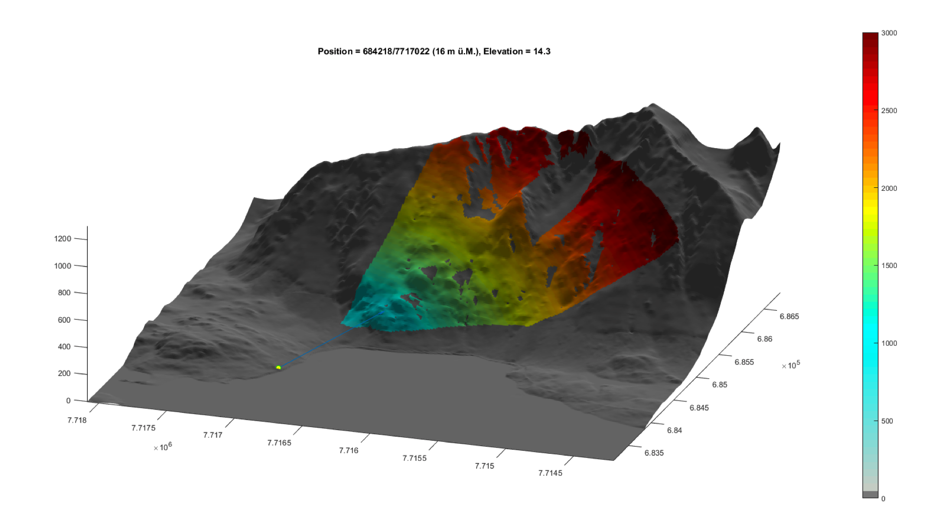
Figure 2: In the second step, the sensor’s field of view is projected onto the DTM. This visualization helps find holes in the sensor’s coverage of the ROI.
Local images and knowledge
In addition to computing the ideal location from a DTM, local images and knowledge of the area are important. This helps verify results from the simulation and take objects that are not included in the DTM (i.e. trees) into account. To guarantee an optimal surveillance, a location simulation is at the start of every Geopraevent radar monitoring project.
Projects that made use of this technology:
• Zermatt avalanche radar
• Glacier monitoring Eigerglacier
• Glacier monitoring Weissmies
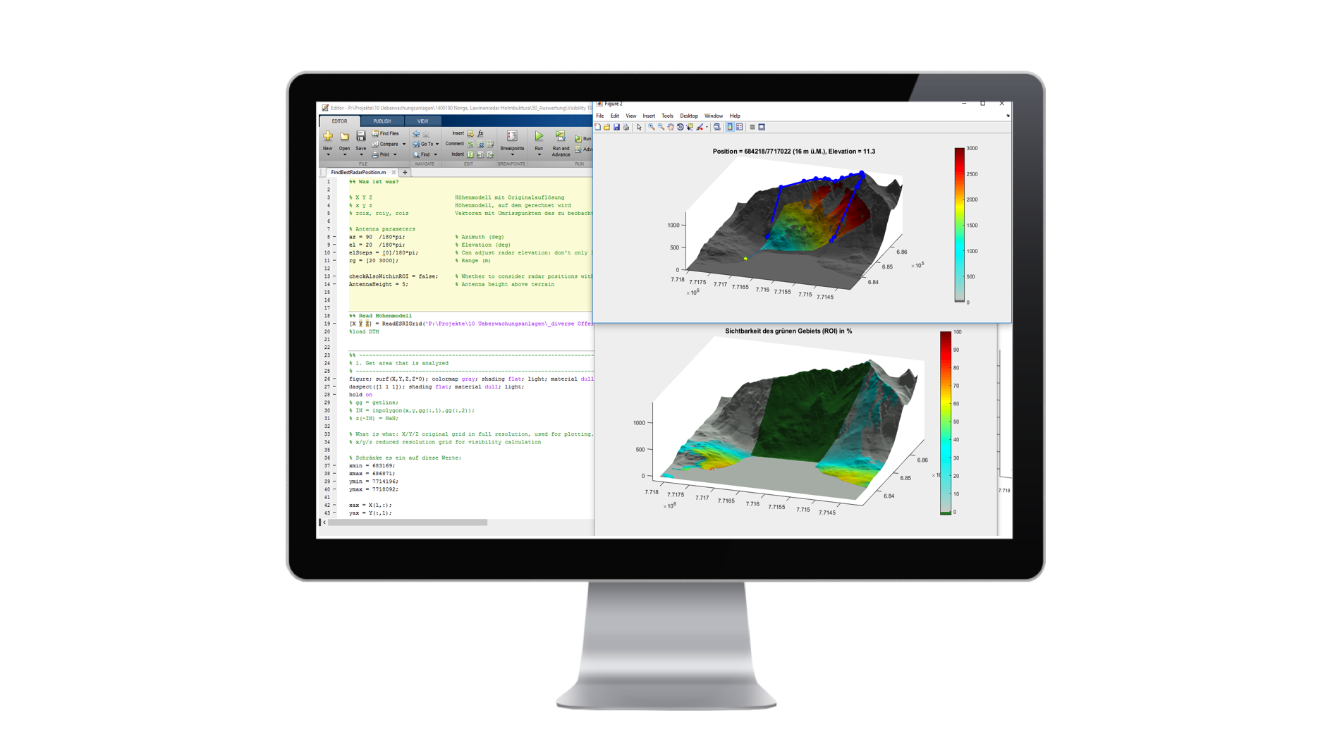 Geopraevent developed its own software to determine the optimal radar location.