Kandersteg: Geoprevent monitors Spitze Stei with radar and deformation camera
The rock slope named “bim spitze Stei” above world-famous Lake Oeschinen in the Swiss Alps has always seen movement (Office for Forests and Natural Hazards of the Canton of Berne). Heavy precipitation often increases slope movement and in recent years the slope has accelerated. The unstable area covers about one square kilometre and has been monitored since summer 2018. GPS and total station measurements have been recorded at specific locations since and we ran a first testing phase with the georadar in late 2019. Subsequently, monitoring was intensified with further measurement technologies. We installed the first high-resolution PRO Cam for monitoring of the uppermost section in summer 2019 and a second device in spring 2020. PRO Cam automatically takes pictures in regular time intervals and uploads the images to the online data portal. This allows natural hazards experts to inspect the area remotely at any time and verify measured displacements or collapses or view slope details.

In December 2019, PRO Cam recorded a rockfall of approximately 15,000 cubic metres. The uppermost part of the prominent pillar at Spitze Stei had collapsed.
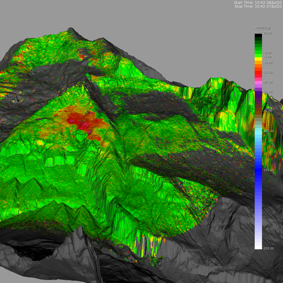
Since June 2019, Geoprevent has also been monitoring the entire north-western slope with an interferometric radar as well as a second PRO Cam. The interferometric radar measures continually scans the slope and measures displacements in the mm range. Measurement data is automatically uploaded to the online data portal for anytime access for authorized users.

The interferometric radar reliably measures slope movements in the mm range in all visibility and weather conditions. Radar and PRO Cam are located on the opposite slope at a distance of more than 2.7 km to Spitze Stei.

View of the snow covered Spitze Stei slope from the radar and PRO Cam location. The red circle marks the prominent pillar of the Spitze Stei slope.
The second PRO Cam is mainly used for visual inspection of the selected section of the monitoring area and allows remote viewing with a high level of detail. As example, the before-after camera images of 20/21 June 2020 show a small rockfall. The deposited material is under the rock where it collaped.
The media release of the municipality of Kandersteg dated 7 August 2020 inlcudes all monitoring devices used at Spitze Stei.
The first high-resolution PRO Cam was installed in summer 2019.
PRO Cam monitors the upper part of “Spitz Stei” above Lake Oeschinen in the Bernese Alps, Switzerland. On the left hand side of the picture is the prominent pillars of the Spitze Stei that collapsed in December 2019.
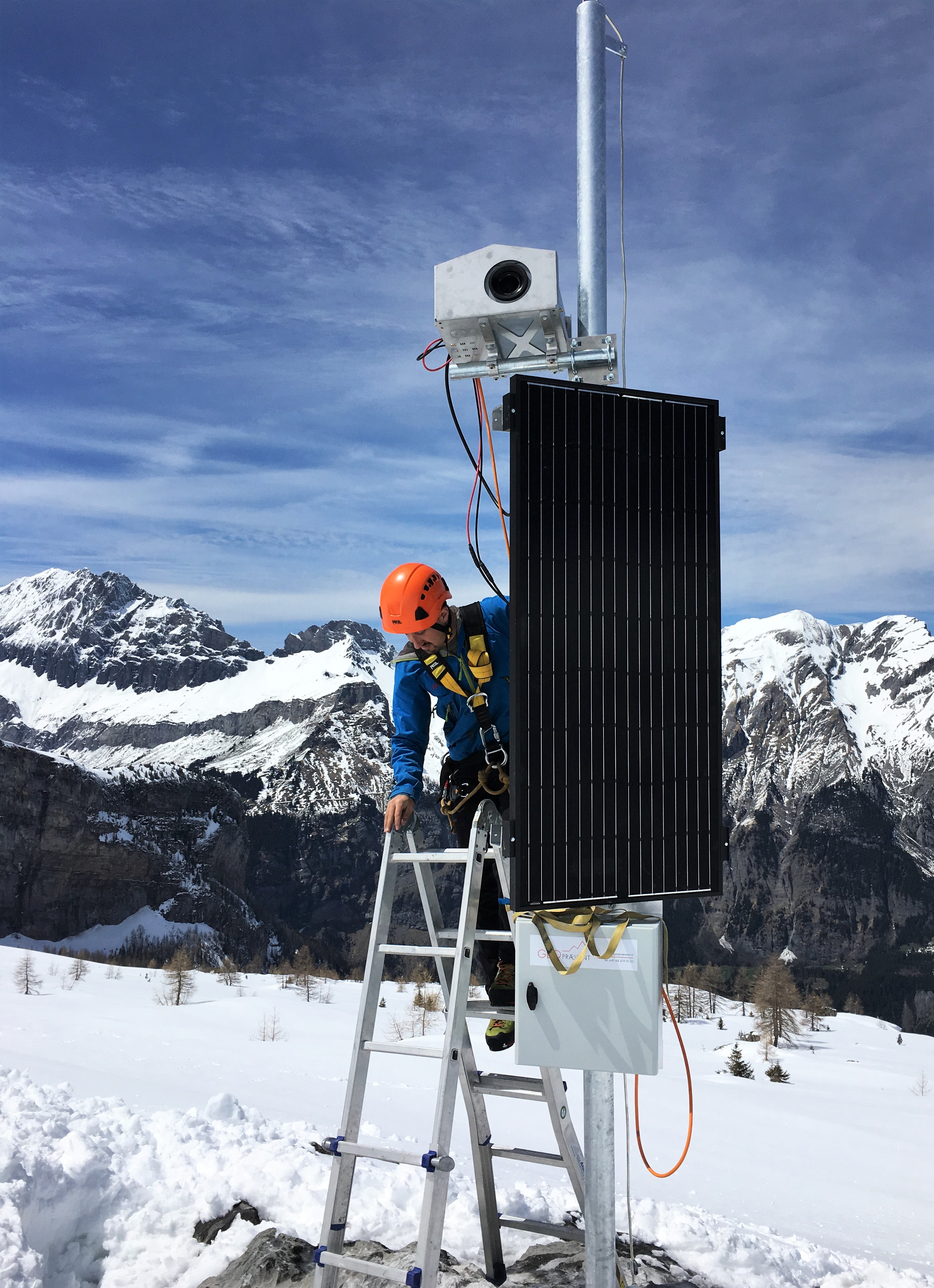
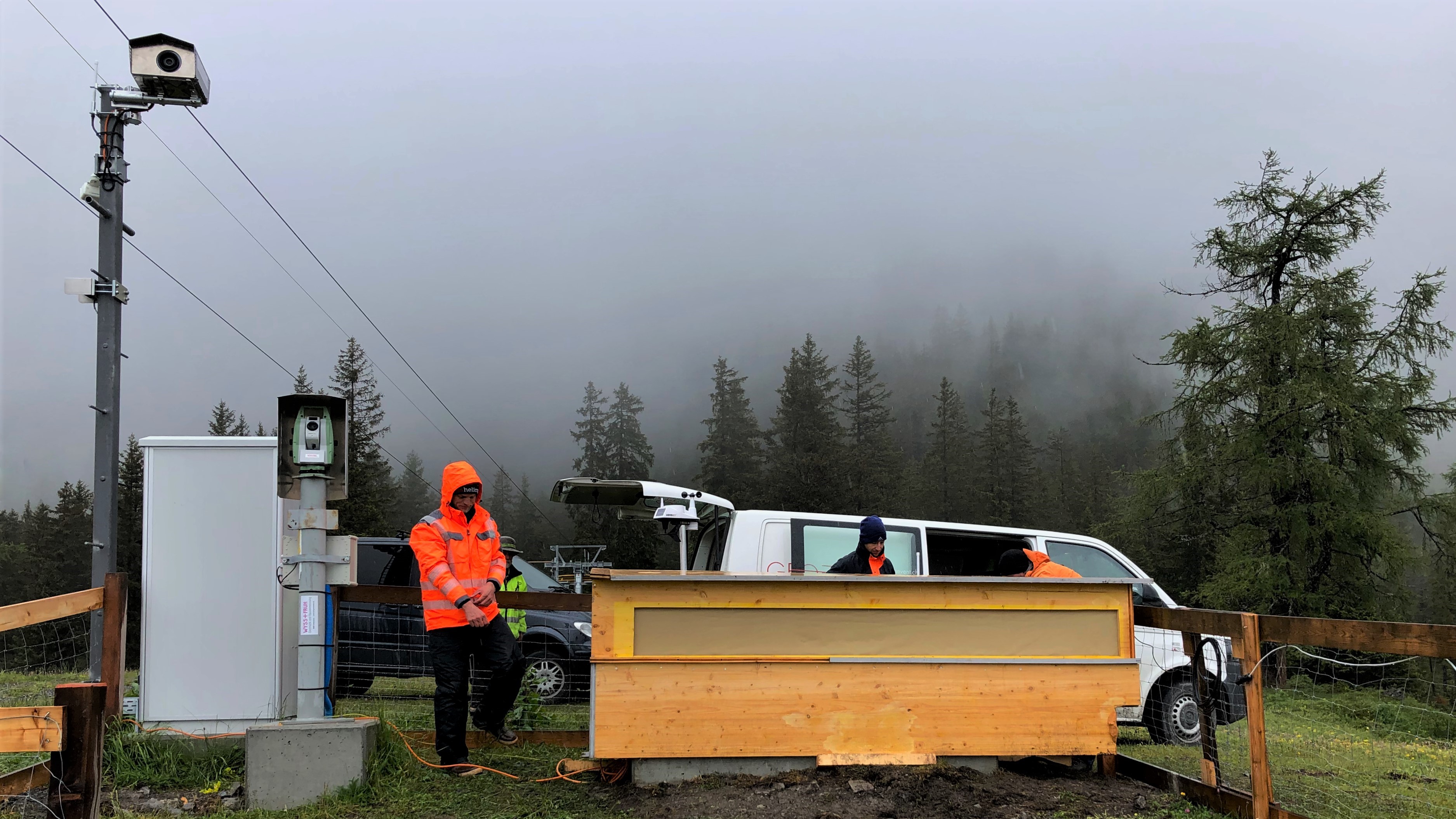
PRO Cam installation by a Geoprevent technician.
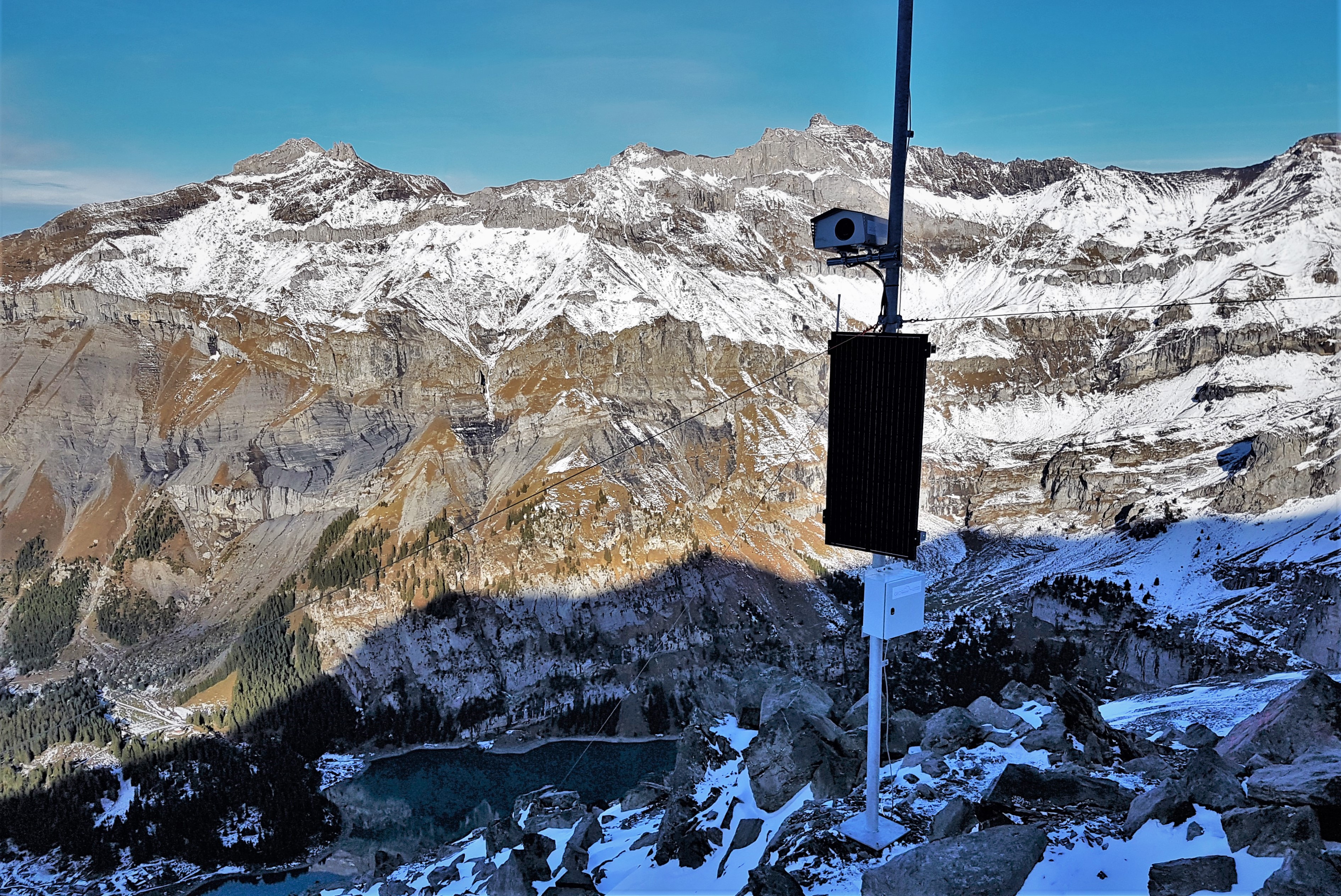
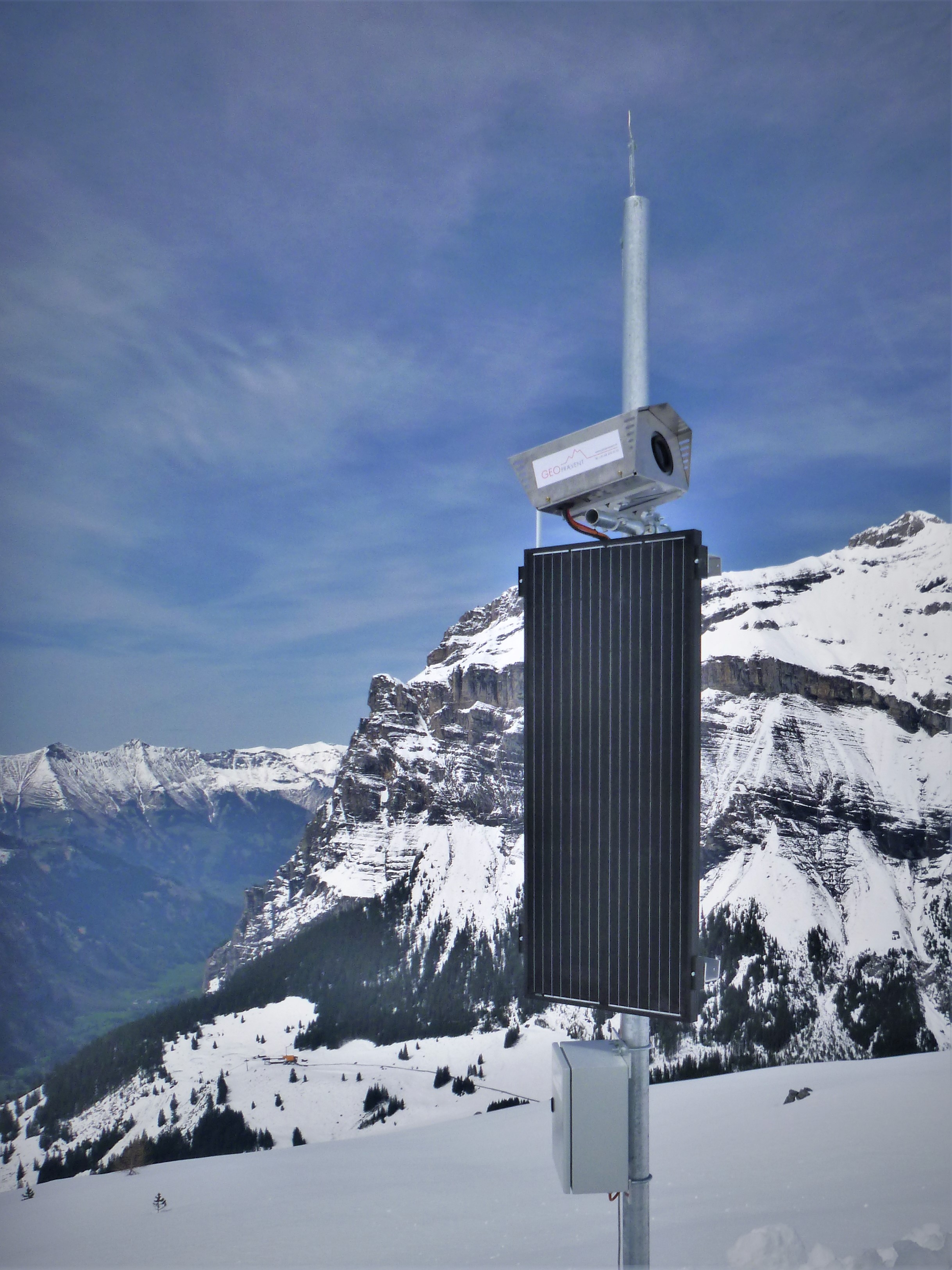
One of the PRO Cam is installed at the side of Spitze Stei slope. a solar panel supplies the camera with electricity. n the background is Lake Oeschinen.
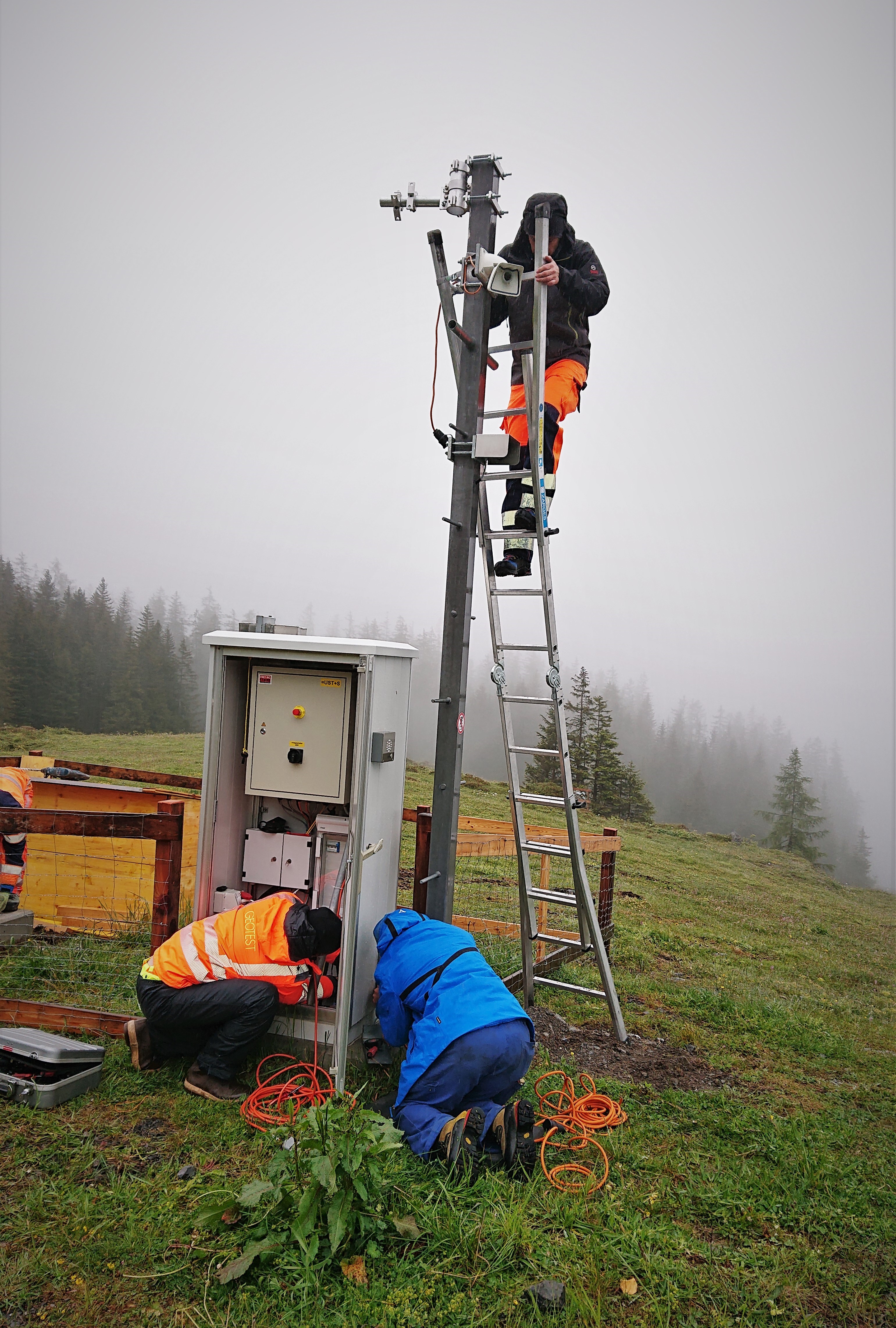
Radar and PRO Cam installation by a Geoprevent technician. System maintenance is mostly done remotely or if required on site.
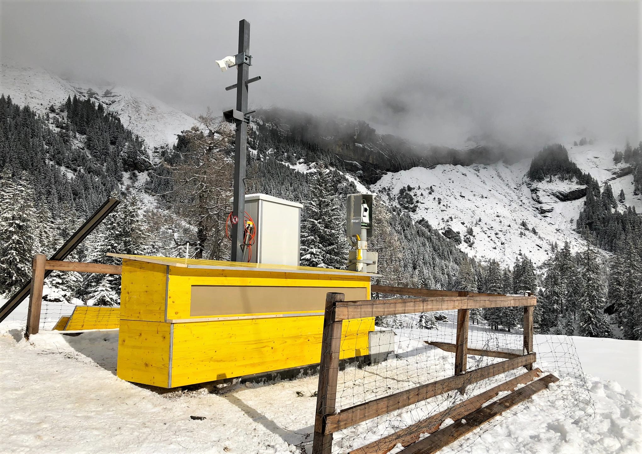
The radar is protected against wind and weather by a shelter construction.
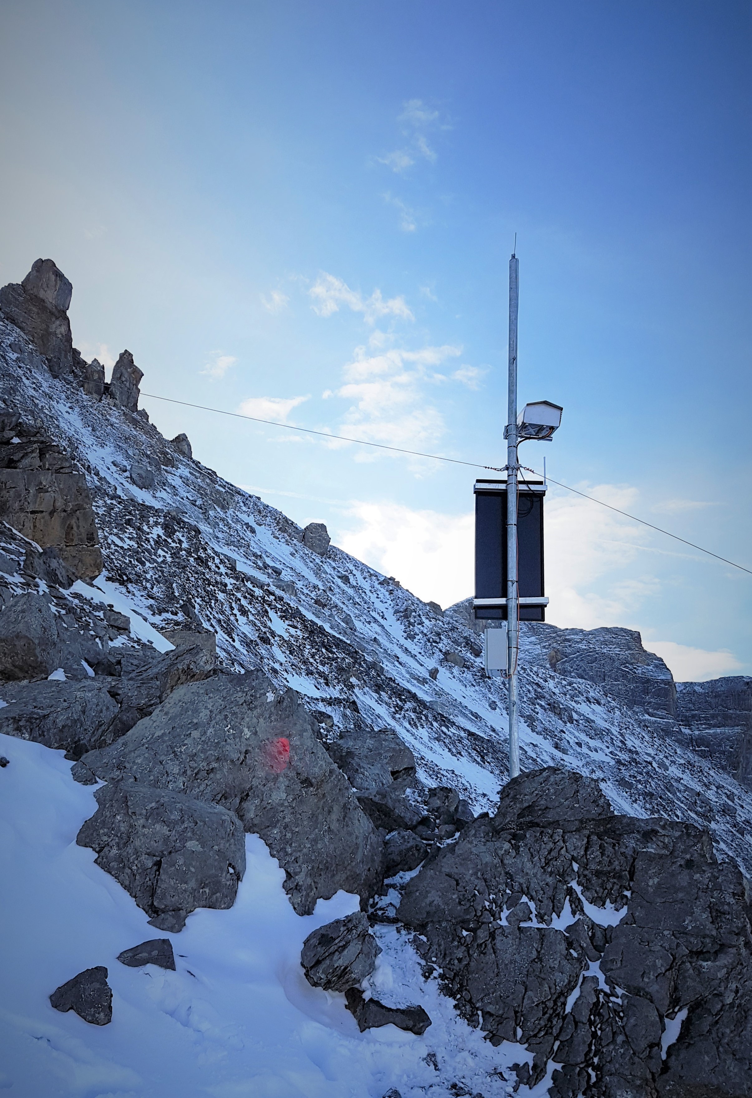
Opposite slope location: the PRO Cam is in upper left corner of the picture, the protection housing for the interferometric radar in the middle of the picture. Other measurement instruments are also located at this site.