GLOF Monitoring Systems in Sikkim, India
Situation
High‑mountain regions worldwide are increasingly affected by Glacial Lake Outburst Floods (GLOFs)—sudden and destructive floods caused by the failure of natural dams holding back glacial lakes. As glaciers retreat due to climate change, new lakes form and existing ones expand, often in unstable terrain. Intense rainfall, slope failures, ice or rock avalanches, or collapsing moraines can trigger sudden lake outbursts with devastating downstream impacts.
In the Indian state of Sikkim, located in the eastern Himalaya, numerous glacial lakes pose a serious threat to communities, infrastructure and hydropower assets. To support local authorities in understanding and managing this risk, GEOPREVENT, in collaboration with Geotest AG, implemented a long‑term GLOF monitoring project at two of the most critical sites in the region.
Solution
With financial support from the Swiss Agency for Development and Cooperation (SDC / DEZA), more than 30 glacial lakes in Sikkim were assessed and categorised according to their hazard potential. Based on this assessment, two lakes were prioritised for detailed monitoring:
- South Lhonak Lake
- Shako Cho Glacial Lake
The main objective of the project was to provide authorities with continuous, near real‑time information from remote and difficult‑to‑access glacial lake environments. At the same time, the monitoring systems were designed to improve the understanding of lake behaviour and its interaction with climatic drivers such as precipitation and temperature. By collecting reliable long‑term data, the project establishes a solid scientific basis for hazard assessment. This data foundation supports the development of future early warning systems and the definition of effective mitigation measures.

Station South Lhonak
Station Shako Cho
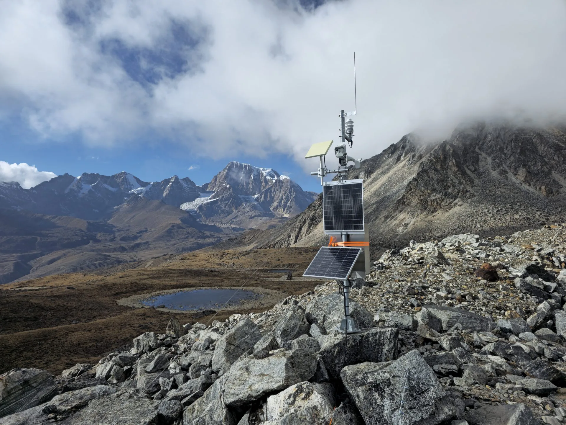
Both monitoring stations are located at elevations above 5000 m above sea level and are accessible only on foot. We designed and installed comparable monitoring systems at both sites to ensure reliability and consistency of the data.
Each installation includes:
- Two high‑resolution (6 MP) cameras for visual monitoring of the lake, potential release zones and downstream hazard areas
- A multi‑parameter weather station measuring air temperature, humidity, precipitation, air pressure, wind speed and direction, and solar radiation
- Lake level and water temperature sensors to monitor hydrological behaviour
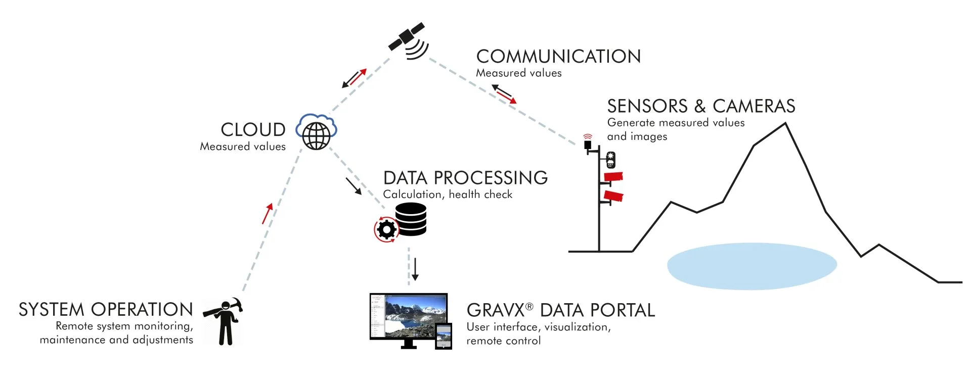
The systems are fully solar‑powered and optimised for low energy consumption. All data are stored locally and transmitted once per day via satellite to our servers. Measurement data and camera images are made available to authorised users via the GRAVX online platform, which can be accessed on PC, tablet or smartphone.
Authorities from the Sikkim State Disaster Management Authority (SSDMA) and the National Disaster Management Authority (NDMA) use the platform on a daily basis to visualise and compare camera images, analyse meteorological and lake data through interactive time series tools, and export data for further analysis and reporting. To ensure long-term operational reliability, all monitoring systems are supported by continuous 24/7 system health monitoring.
South Lhonak GLOF 2023
South Lhonak Lake is considered one of the most dangerous glacial lakes in the region. On 4 October 2023, only 17 days after the installation of our first monitoring system, a catastrophic GLOF occurred. Following intense rainfall, a lateral moraine collapsed and triggered a sudden lake outburst.
The flood caused numerous fatalities and widespread destruction along more than 100 km of the Teesta River, including bridges, settlements and a hydropower dam.
Following the GLOF event, GEOPRAEVENT supported the installation of additional monitoring components at the site and participated in technical workshops together with Indian authorities. These discussions focused on evaluating options for the implementation of a future GLOF alarm system as well as additional structural and organisational mitigation measures.
Today, the monitoring system is operated by the Sikkim State Disaster Management Authority (SSDMA). Scientists from the Department of Science and Technology (DST) actively use the collected data to develop and refine improved hazard management strategies for the region.
Customer
Swiss Agency for Development and Cooperation (SDC/DEZA)