Monitoring of a landslide prone slopes in the Karratfjord, West Greenland
Challenge
The risk of landslides and rock avalanches is increasing in the Arctic with climate change. In some cases, the landslides are large enough to generate tsunami waves devastating nearby localities. These cascading events represent a high risk for arctic regions such as Alaska, Northern Canada and Greenland. In the Karratfjord, Western Greenland, impulse waves or tsunamis generated by rock avalanches can endanger the Nuugaatsiaq fishermen village located nearby as well as further locations in the vicinity.
On the 17th of June 2017, an estimated 54 Mio m3 deep-seated rock avalanche occurred in this fjord, generating a tsunami with a run-up wave of ca. 10 m, reaching Nuugaatsiaq ca. 7 minutes after the event and resulting in 4 fatalities and the destruction of 11 buildings. An analysis of satellite data revealed that several landslides happened in this fjord in the past and that there were three different active zones that could also endanger several villages in case of landslide tsunamis. The inhabitants of two villages therefore had to be evacuated until a solution could be found.
Solution
The government of Greenland decided to implement an Early Warning System (EWS) to monitor closely the landslide situation. As such Early Warning Systems often are complex and have multiple components requiring expertise from diverse fields, a consortium with different companies and research institutions was set up. The idea for the Early Warning System was to set up some cameras and to perform image analysis of the dangerous slopes to monitor and detect any acceleration or regime changes of the instabilities. Additionally, it was planned that in a second phase, seismic sensors would be installed in order be able to automatically alarm the population of Nuugaatsiaq and other villages at risk in case of cascading landslides and tsunamis.
GEOPRAEVENT became an important partner for cooperation with the Greenlandic government. In 2022 we installed PROCam camera-based systems to regularly take images of the three dangerous slopes and to detect any acceleration of the existing instabilities with the DEFOX™ image processing technology.
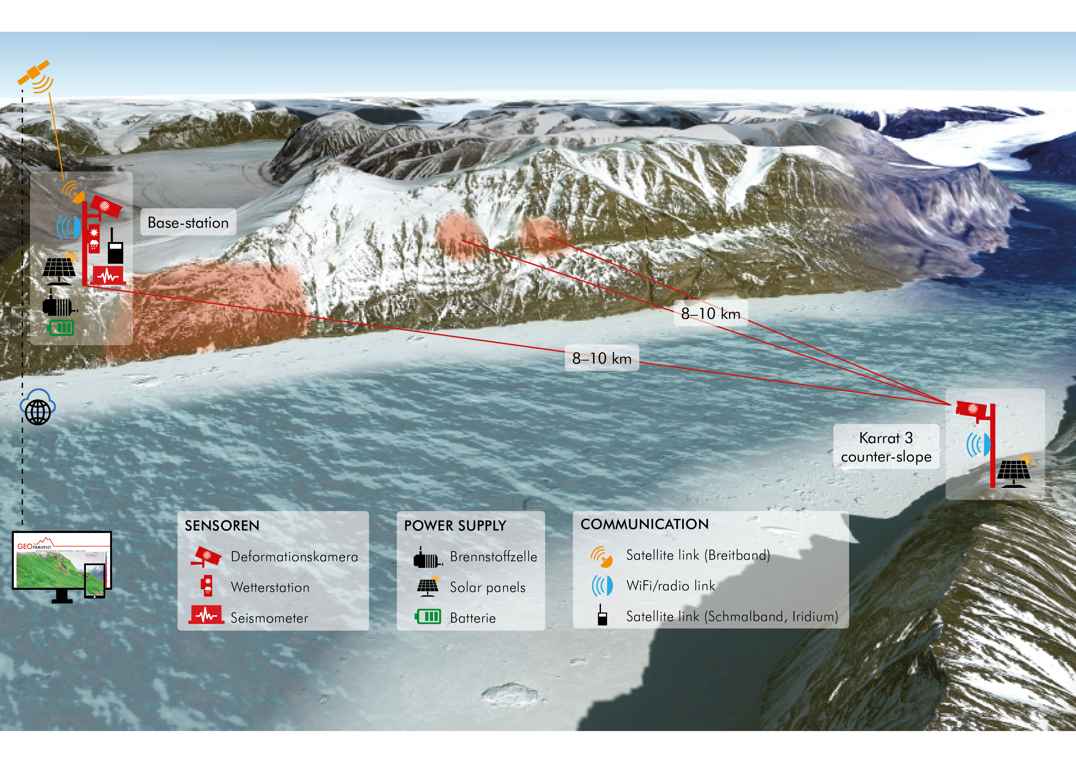
Schematics of the Early Warning System installed at Karrat with stations on both sides of the fjord and the three zones monitored.
The power supply of these systems is ensured by combining a methanol fuel-cell and solar panels coupled with a battery system. Additionally, GEOPREVENT recommended to use the GRAVX online data platform for data hosting and to integrate the seismic data on the portal.
For GEOPREVENT, this project presented several difficulties. First, the remoteness of the installation and the rough arctic conditions, e.g., the almost three months of polar night are quite demanding conditions on the hardware side. Secondly, finding optimal locations for the cameras was challenging, because a trade-off had to be found between the best view as possible on the instabilities to obtain optimal deformation analysis data and the fact solar yield had to be maximized to avoid methanol over consumption. Thereby, several interesting locations could not be further considered because the system may have been impacted by waves originating from tsunamis in case of an important event. A last challenge was the distance of 8 to 10 km between the active zones and the camera positions. At these distances, GEOPREVENT was concerned about the influence of atmospheric disturbances on the quality of the image data and on the results of the deformation analysis. These concerns turned out not to be a major issue as the low temperatures and the corresponding low relative humidity ended up not exerting such a negative influence on the deformation analysis.
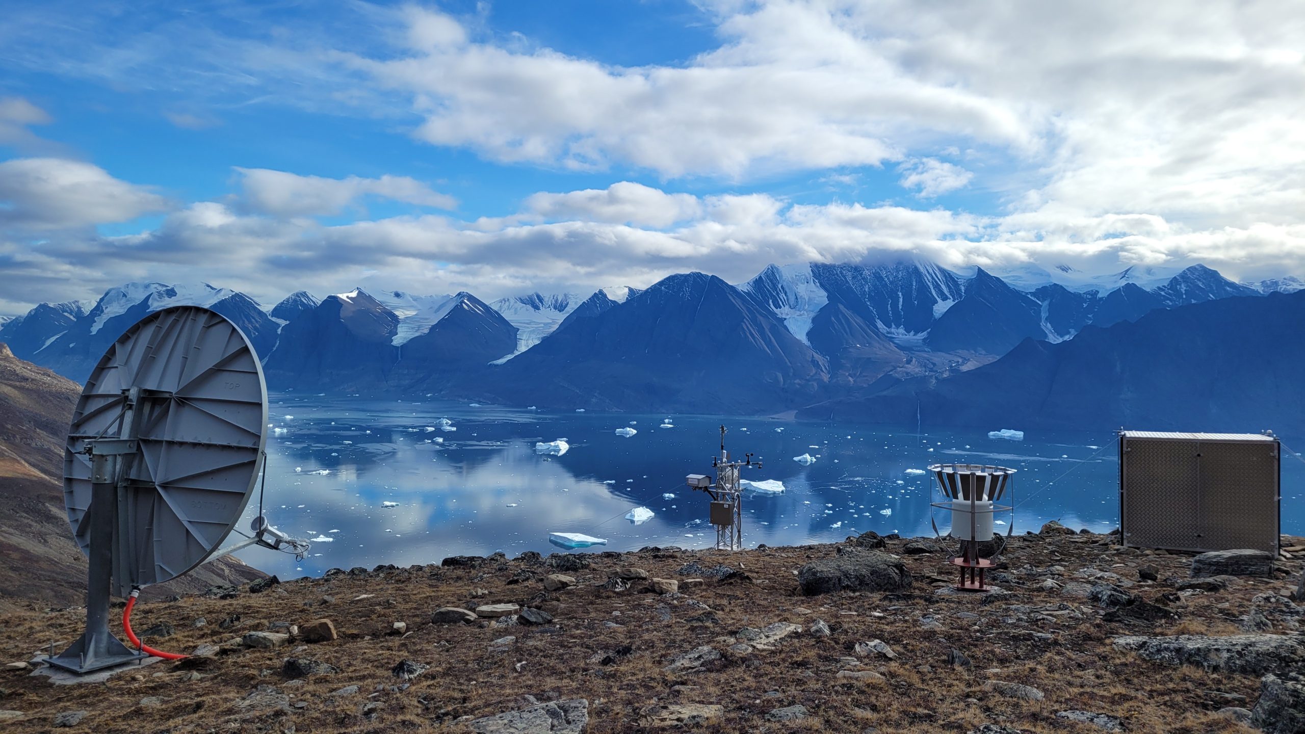
Karrat Base station
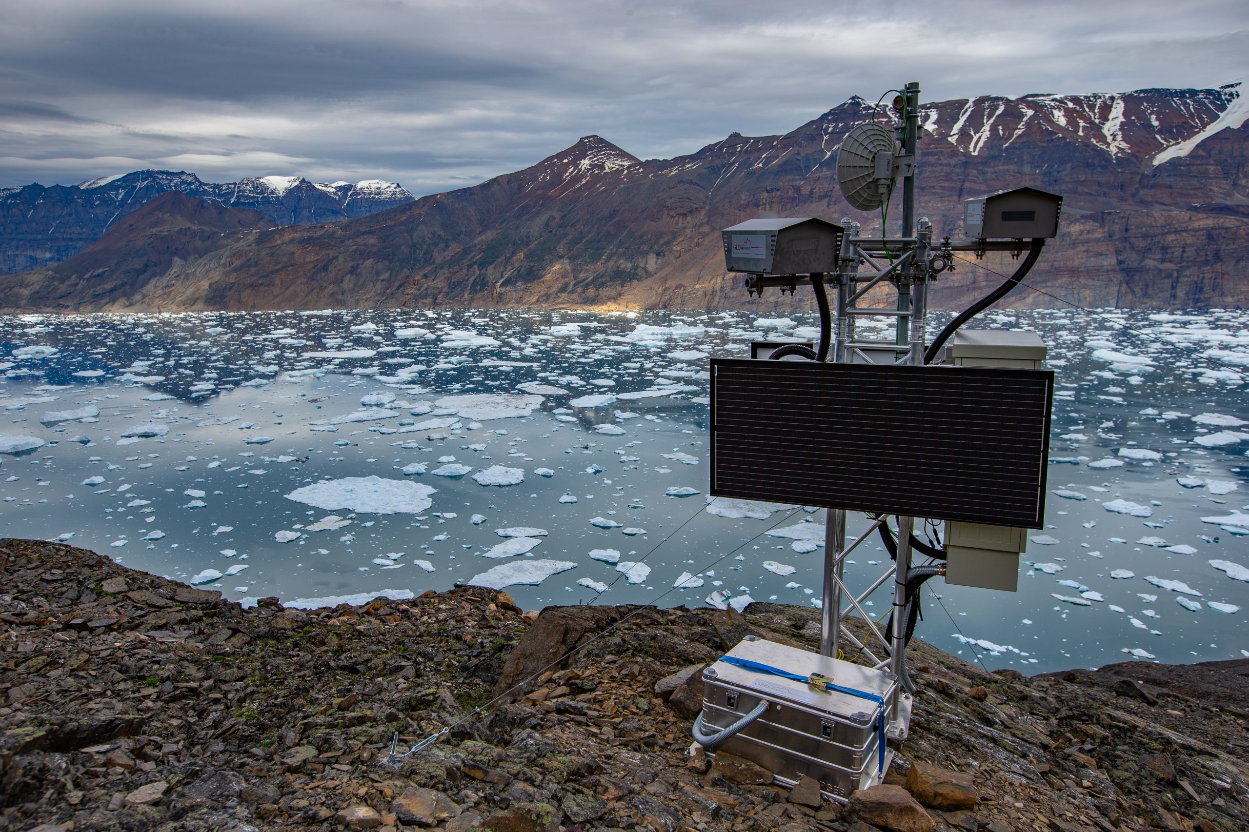
Karrat counter-slope
Based on different simulations and considering the challenges mentioned above, GEOPREVENT recommended to install two systems on both sides of the fjord. One on the same side of the fjord as the three slopes prone to rockfalls, on the west side of the most unstable landslide, and one on the other side of the fjord. At the first station (base station), both a broadband and a narrowband satellite connection were set up, with the former serving as the main connection for transmitting high-resolution images to GEOPRAEVENT’s servers and the latter serving as redundant access to the system when needed. Redundant radio and Wi-Fi connections were set up to transfer data from one station to another.
The system was installed in the summer of 2022 and upgraded the following year to overcome some initial issues. The quality of the image data produced is surprisingly good, and the results of the deformation analysis make it possible to identify the three dangerous zones and monitor their development over time, so that the population in the fjord system can be protected and regularly informed about the situation.
More information
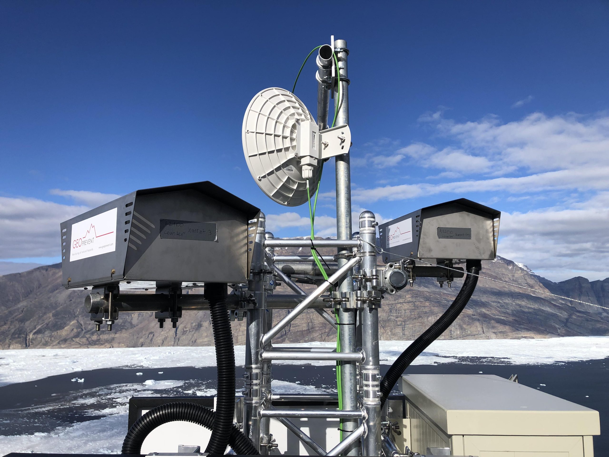
Station Counter slope.
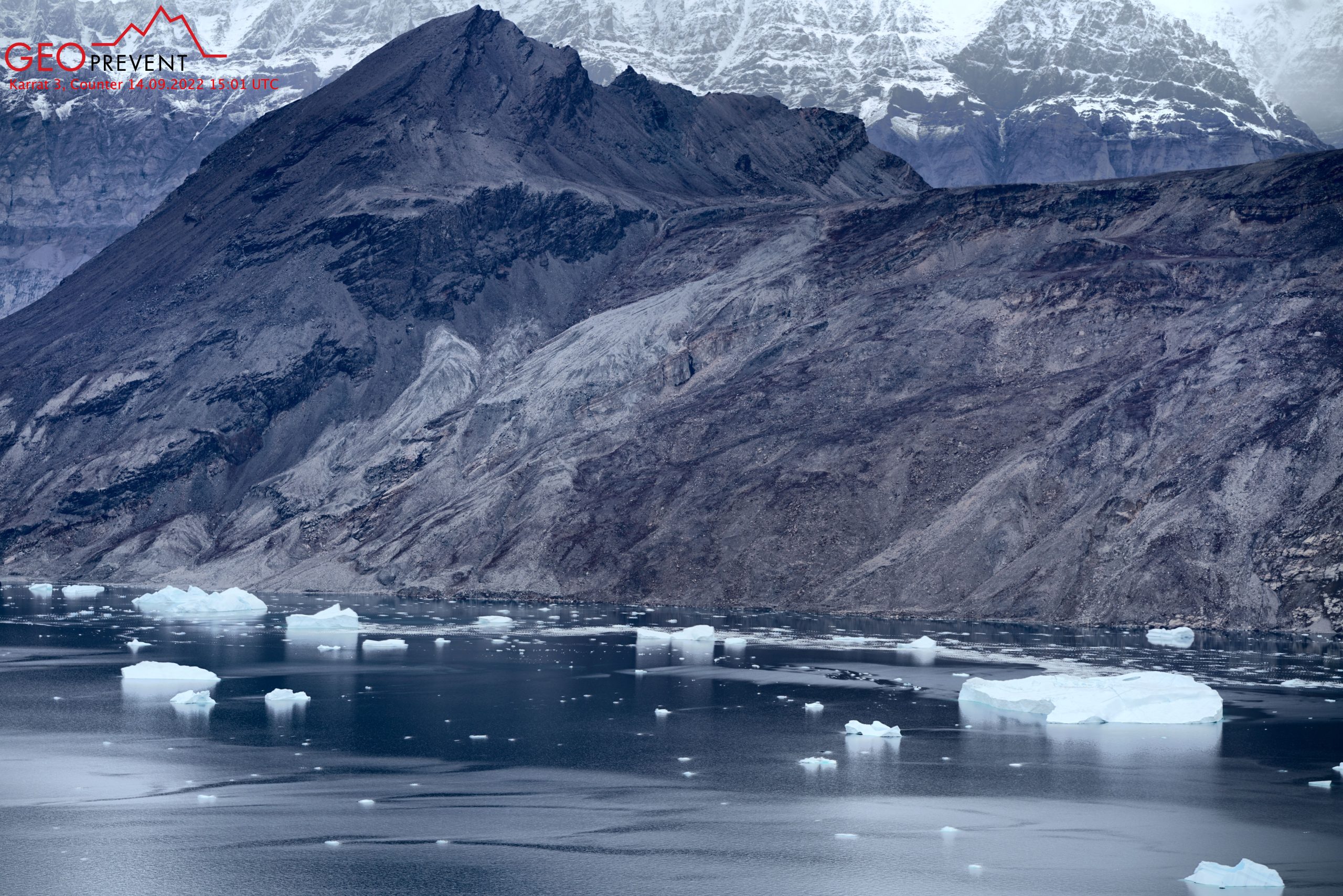
View from the station Counter slope.
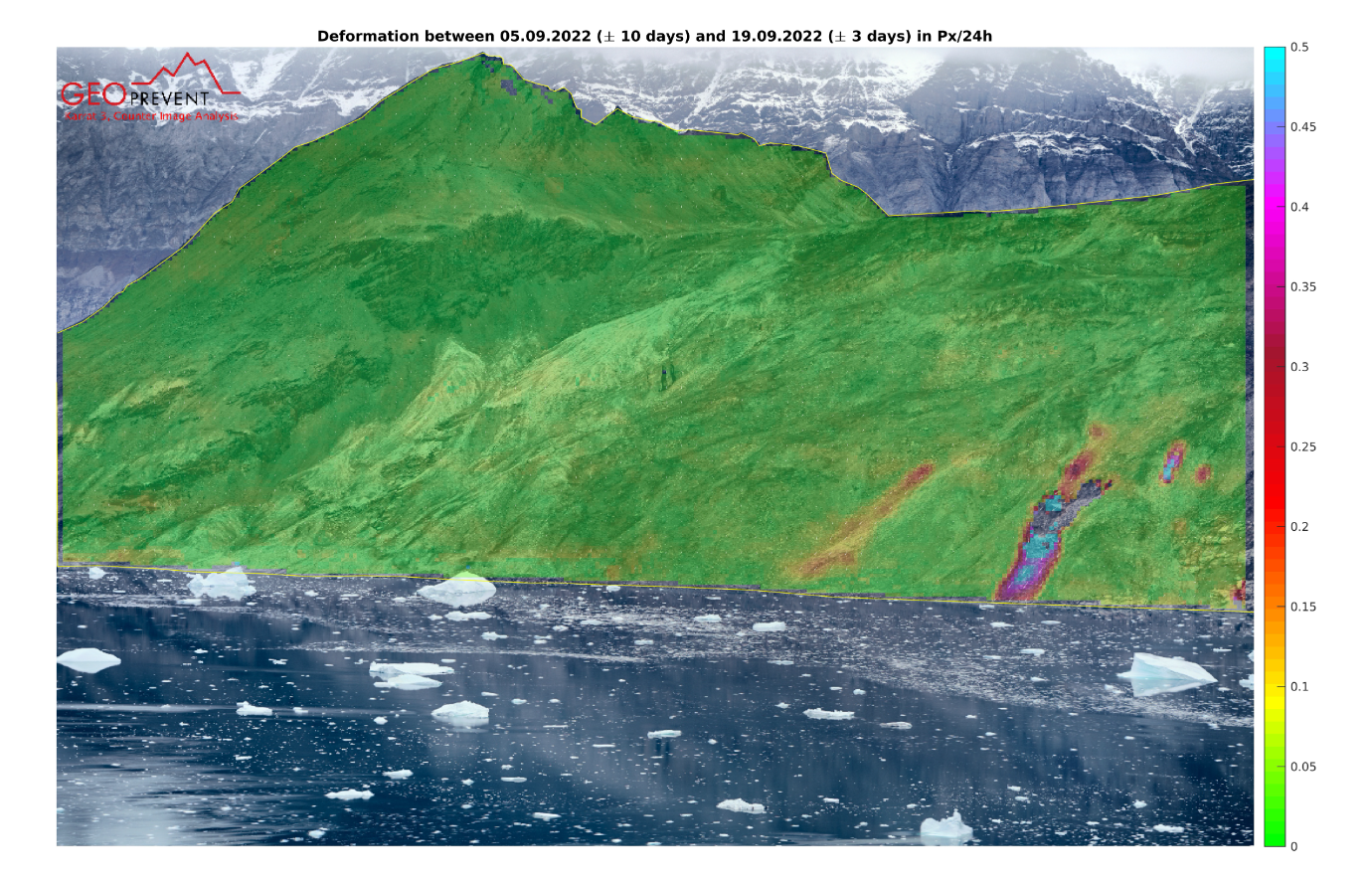
Deformation analysis in September 2022, station Counter slope.
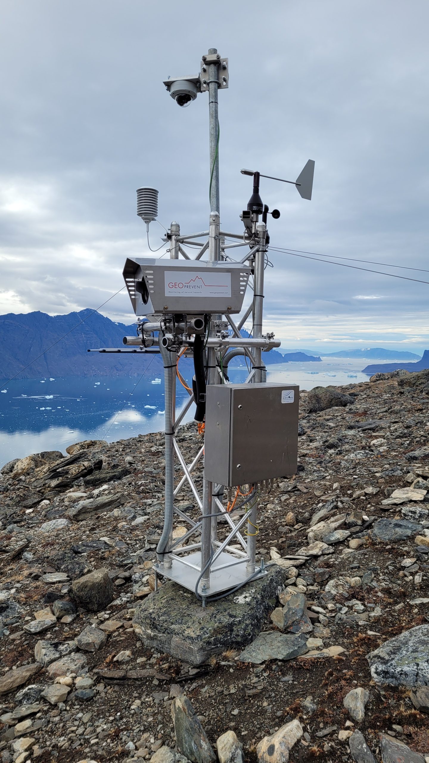
Base station Karrat 3.
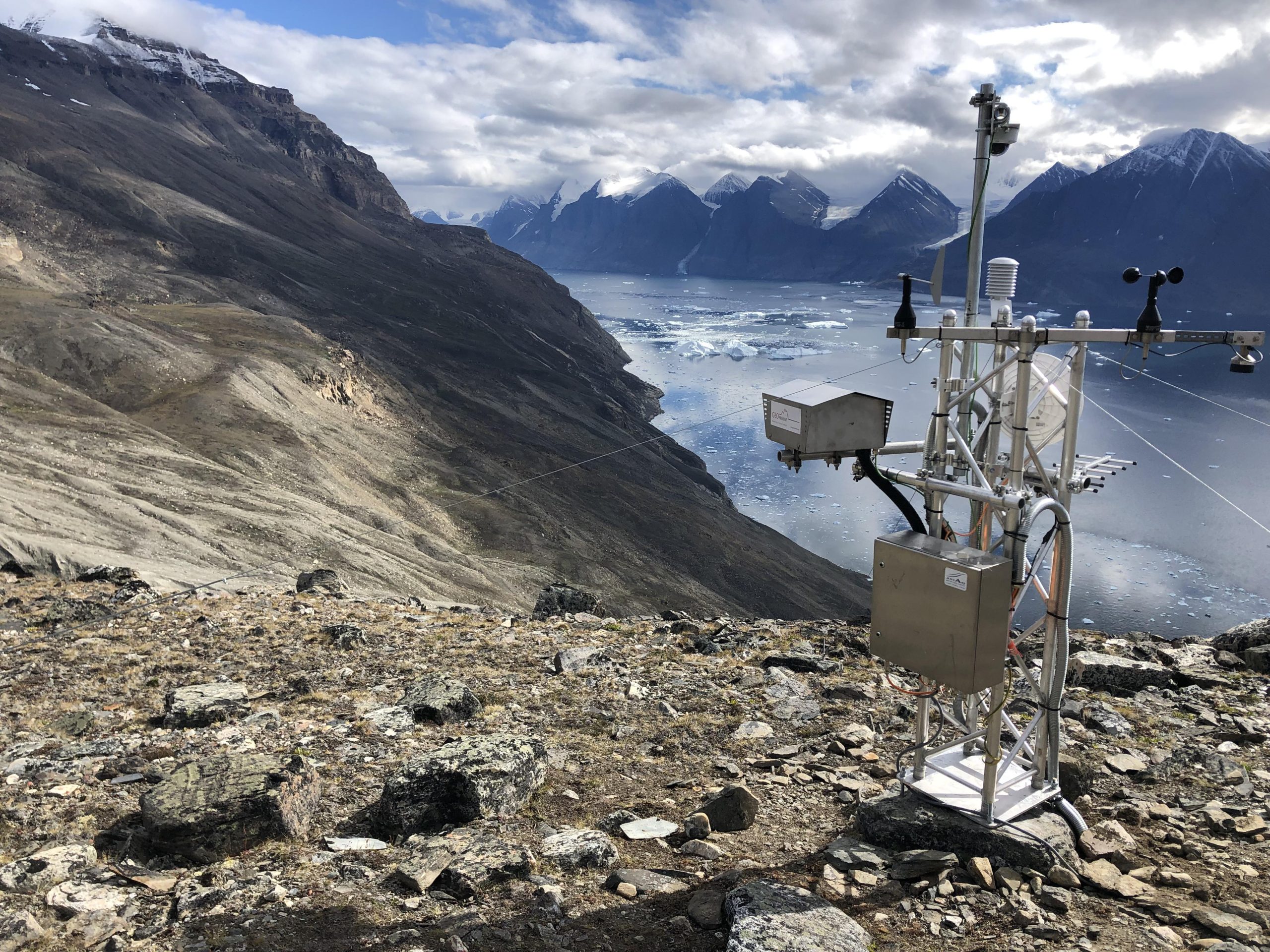
Karrat 3, Base station.
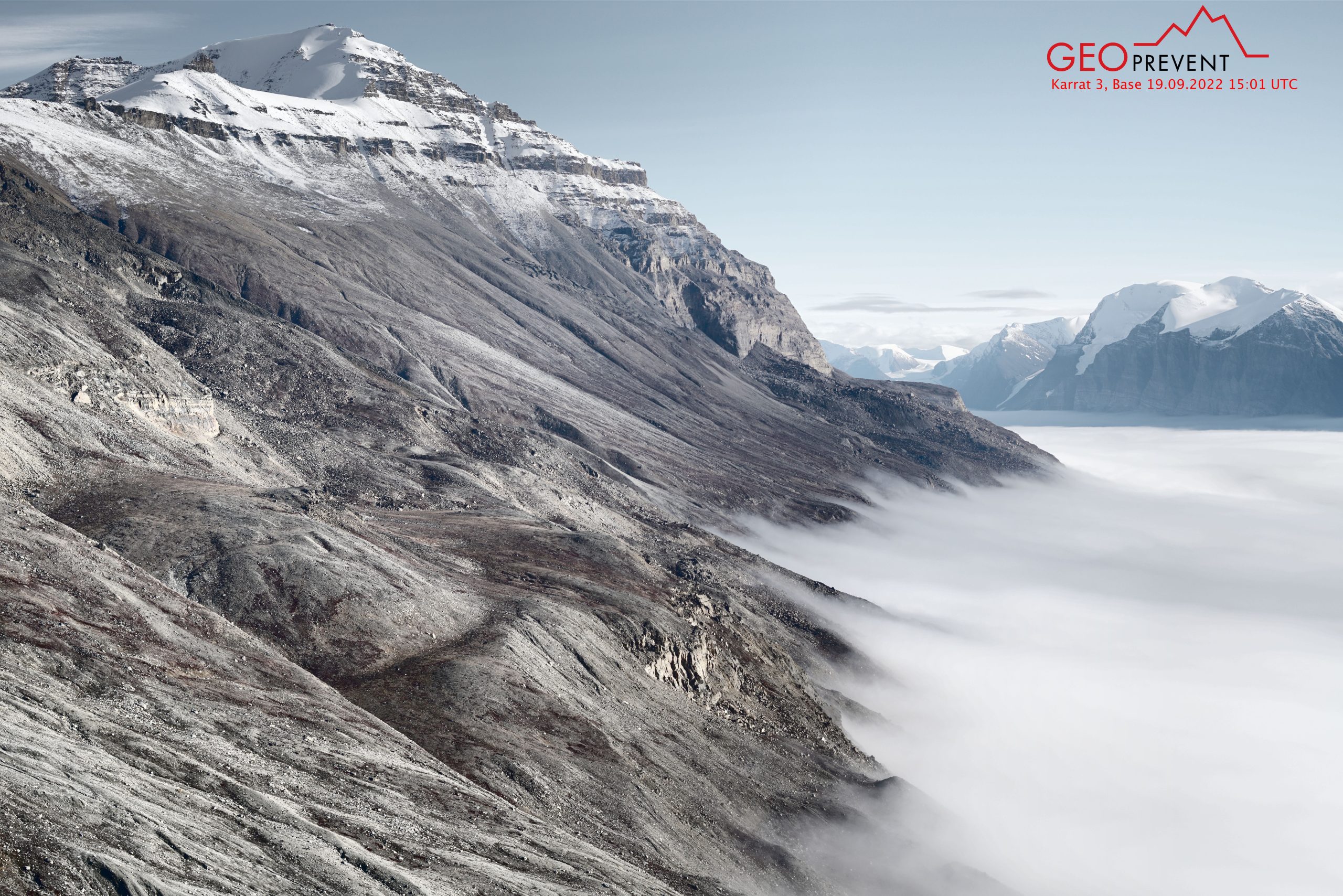
View from the station Karrat 3 Base station.

 Government of Greenland