
Monitoring system in Brienz/Brinzauls, Switzerland
Challenge
Slope instabilities pose a significant threat to alpine settlements and infrastructure. The Swiss mountain village of Brienz/Brinzauls is located in the Albula Valley at an altitude of approximately 1,150 meters above sea level in the canton of Grisons, which has been threatened for decades by a large, slowly creeping landslide. In recent years, the movement of the slope has accelerated dramatically, leading to the development and operation of a comprehensive early warning system.
The geomorphological conditions—a highly fragmented, weathered flysch slope—have always favored recurring mass movements. While the terrain had only moved slowly in the decades prior, the deformation rates increased steadily from 2010 onwards. In 2020, the landslide velocities were around 3–5 meters per year, rising to up to 20 meters per year in the most active areas by the end of 2022. Immediately before the slope failure in June 2023, movements of over 40 meters per day were even measured locally. This dynamic development had a direct impact on the village’s infrastructure and on transport routes in the valley, including the cantonal road and the Rhaetian Railway line (RhB).
Solution
Local authorities began setting up an early warning system (EWS) back in 2011, which has been continuously expanded. It combines traditional geodetic methods such as GNSS stations and total stations with modern sensor-based systems such as inclinometers, seismic sensors, periodic lidar scans, innovative radar technologies, and image analysis methods.
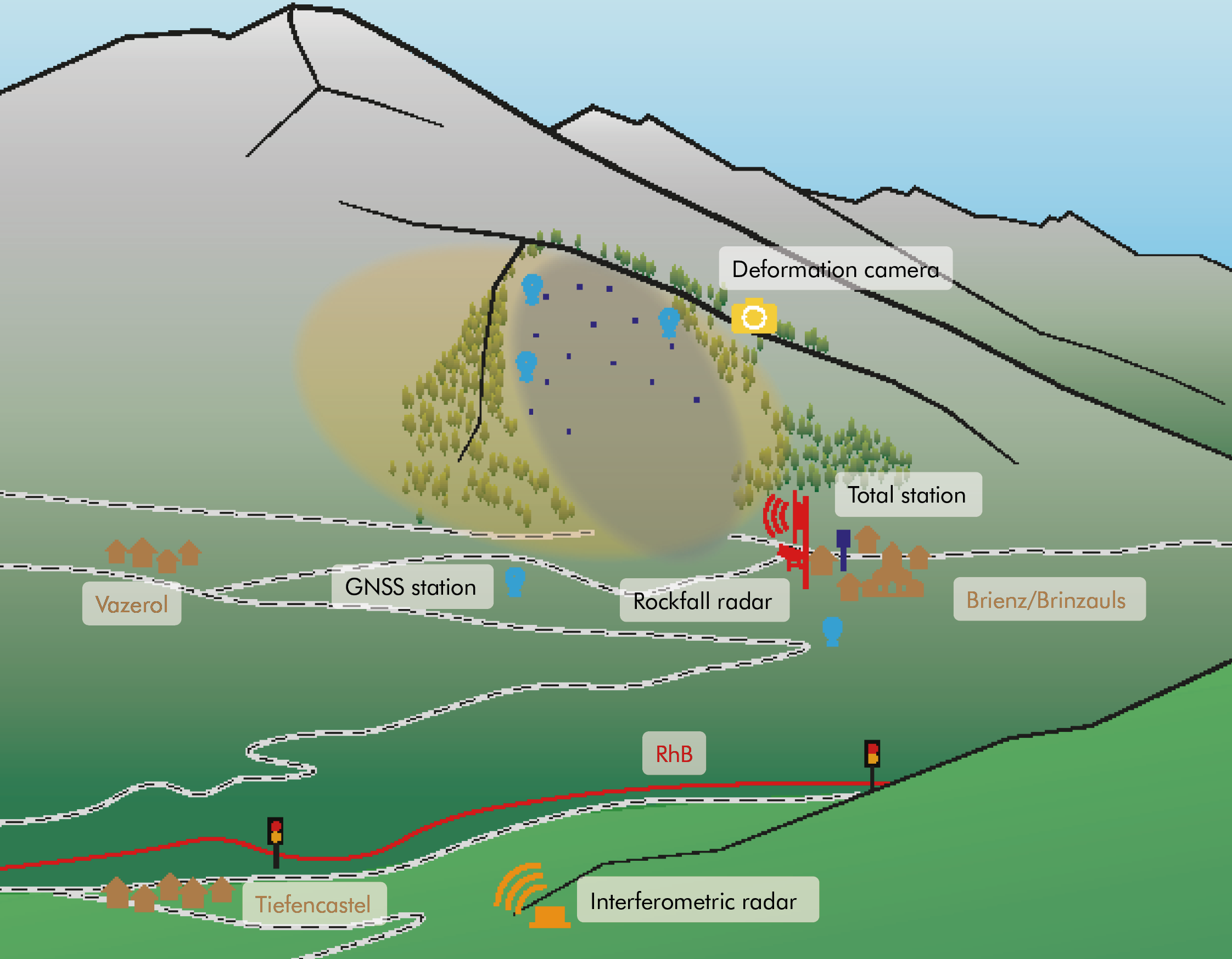
Overview of installations in the Brienz area for monitoring the landslide zone.
In April 2019, GEOPREVENT installed a ground-based interferometric radar for comprehensive monitoring of the entire slope. The device scans the slope every few minutes and provides movement data with millimeter accuracy. The selected position of the radar—on an opposite slope above Tiefencastel—offers an optimal view of the main movement zones of the landslide.
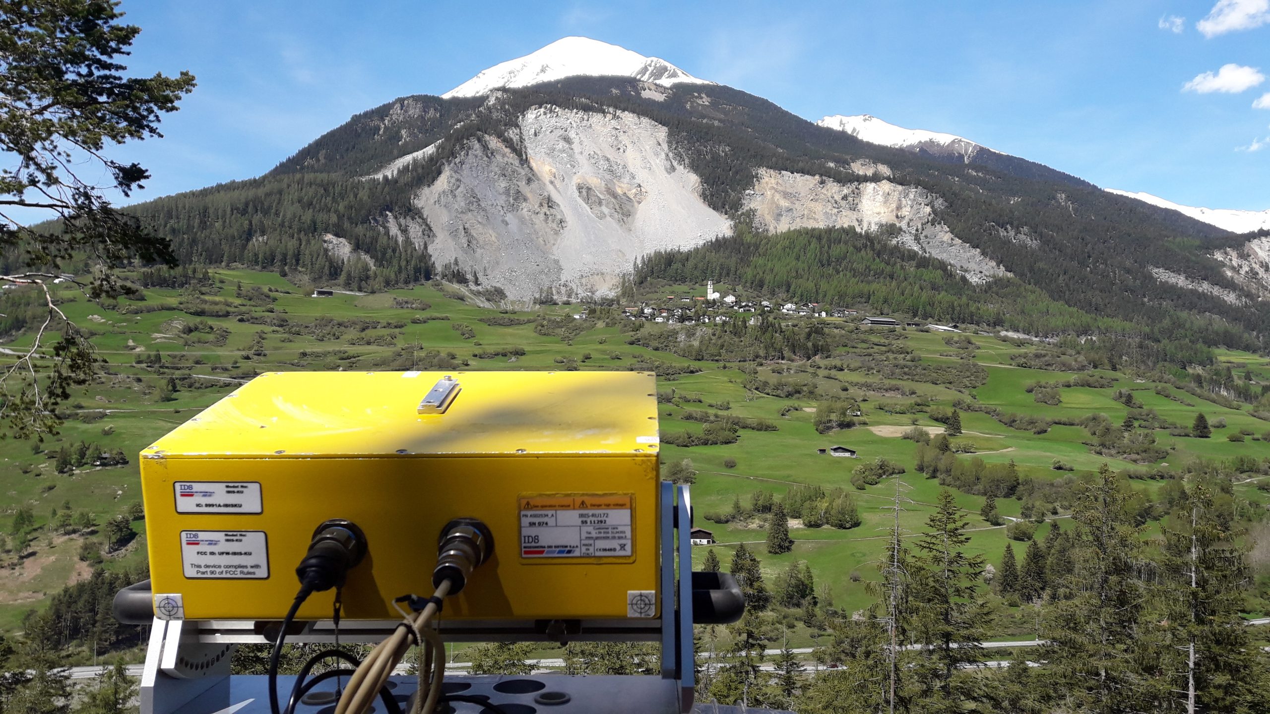
Interferometric radar with a view of the endangered slope before the rockfall in 2023.
The radar operates completely independently, as there is no mains power supply on site. Power is supplied by a combination of solar panels and a methanol fuel cell. The data collected is transmitted via mobile communications to the GEOPREVENT cloud, where it is processed and made available in the GRAVX data portal.
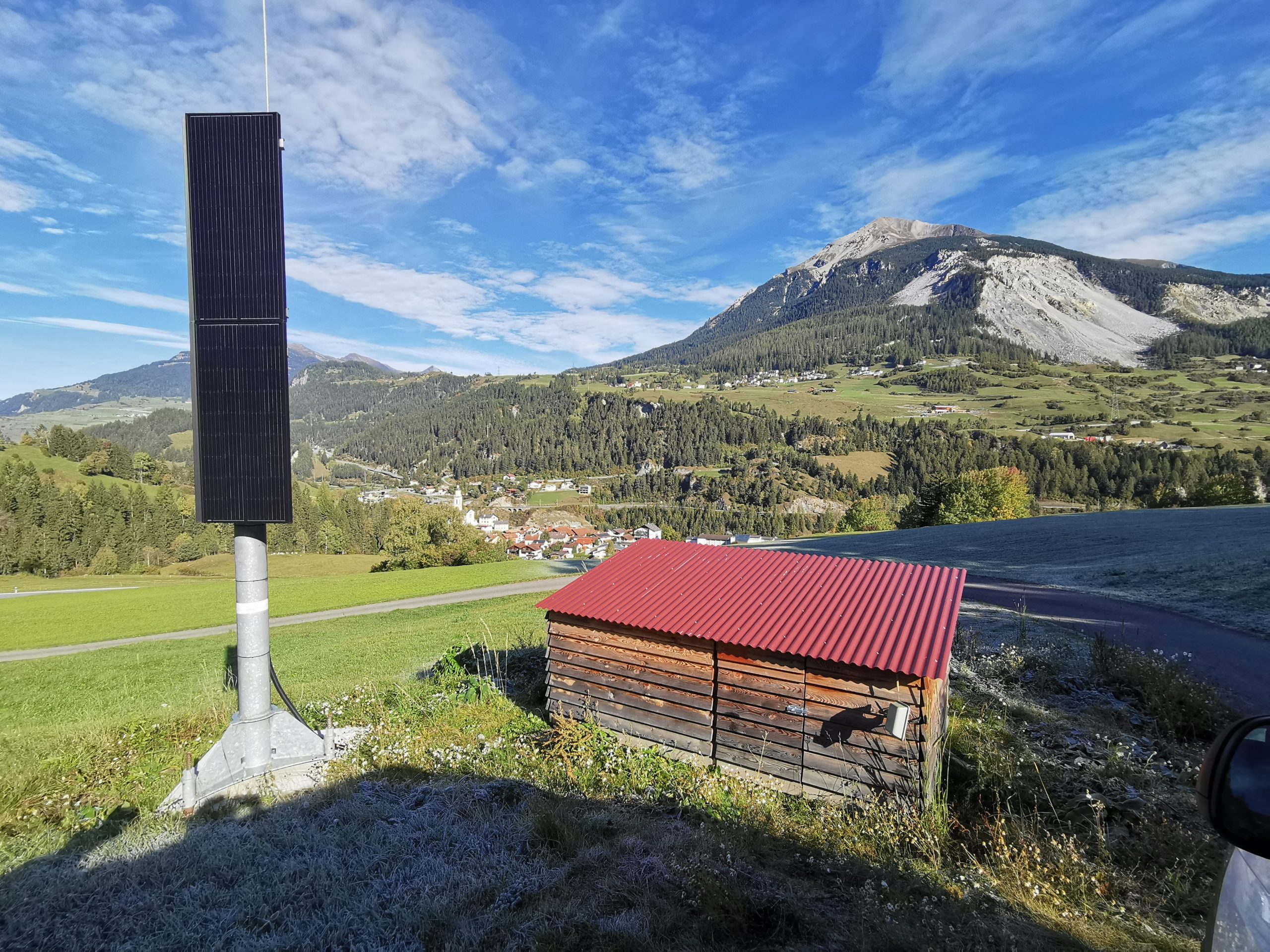
The self-powered radar system with protective housing at its location above Tiefencastel, with the landslide area on the other side of the valley in the background.
During the acceleration phase in early 2023, the radar provided crucial information about impending instability. The data made it possible to identify critical zones on the slope at an early stage and to initiate targeted warning measures.
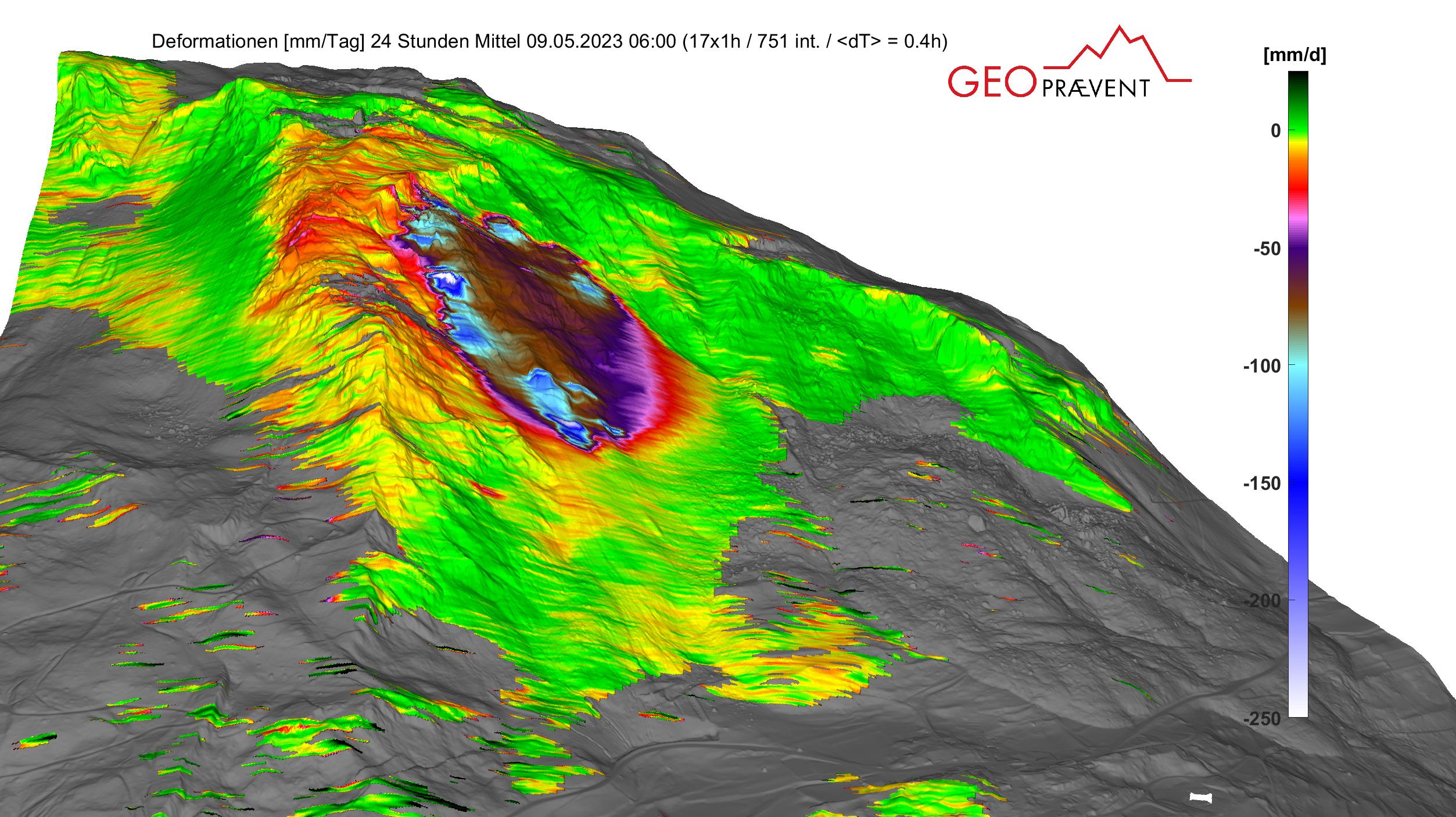
Interferometric radar measurements from May 9, 2023, approximately one month before the rockfall, depicted in a digital elevation model.
In 2023, the monitoring system was expanded to include an energy-autonomous, high-resolution deformation camera. The camera was installed east of the landslide area and delivers 42-megapixel images every hour. These are used to generate a deformation analysis once a day.
The image data is automatically transferred to the cloud, analyzed, and visualized in GEOPREVENT GRAVX’s online data portal. The camera is specially designed for harsh alpine conditions and operates independently of the power grid. A special feature is the night mode, which delivers high-resolution images even in darkness. In the run-up to the rockfall in June 2023, this camera was used to clearly identify the particularly active zone – the so-called “island.” The time series derived from this documented a significant acceleration of the slope movements a few days before the event.
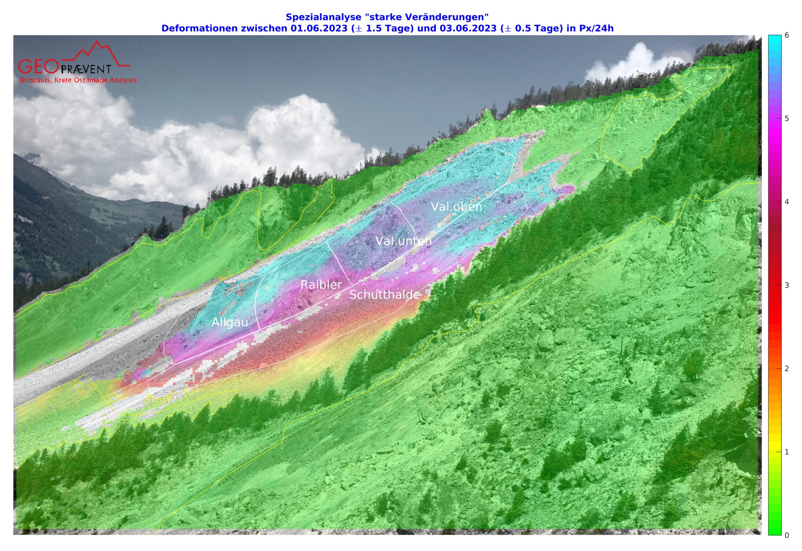
Results of the displacement field determined using deformation analysis several days before the collapse, with various regions of interest (ROIs) defined and outlined in white.
A key element of the EWS is the Doppler radar for detecting rockfalls, which GEOPREVENT installed on a trial basis in 2017 and brought into full operation in 2018. The system monitors a 480-meter section of the access road to Brienz/Brinzauls, which is particularly exposed to rockfall hazards.
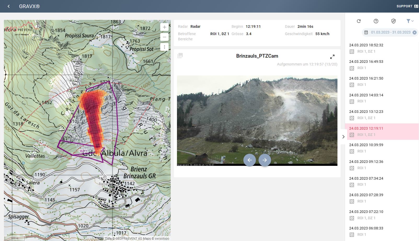
Left: Rockfall radar. Right: View of the Doppler radar results as displayed in the GRAVX online data portal. All events are mapped and displayed with the corresponding event images and characteristics, such as time, duration, length, and average front speed. The map shows two ROIs for the trigger and the danger zone.
The radar detects moving objects using the Doppler effect and reliably distinguishes between rock falls and other moving objects such as animals or vehicles. If an event is detected, the system switches two traffic lights to red within seconds, preventing vehicles from entering the danger zone. In addition, cameras are activated to document the event – even at night thanks to infrared lighting.
Since its installation, the system has recorded over 10,000 rockfall events. In the months leading up to the rockfall in June 2023, daily rockfall activity increased significantly. This observation was interpreted as an additional indicator of slope destabilization. After the rockfall, the monitored section of road became impassable and the automatic closure function was deactivated. However, monitoring of rockfall activity remained in place and continues to provide important data for risk assessment.
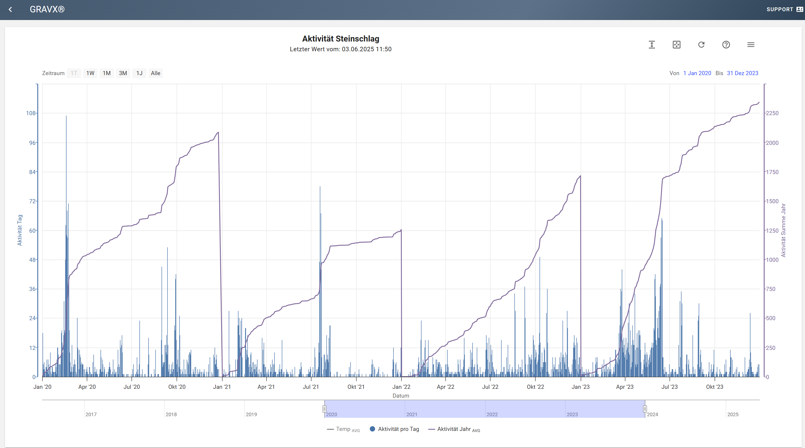
Rockfall activity from January 2020 to December 2023. The vertical lines represent the number of rockfall events per day, with the dark blue line showing the cumulative number per year. This value is reset to zero at the end of each year.
All these systems are integrated into the cloud-based GRAVX data portal, which centrally collects, processes, visualizes, and makes the collected measurement data available to a wide range of users, from emergency responders to decision-makers.
On May 13, 2023, the population of Brienz/Brinzauls was evacuated as a precautionary measure after the measuring systems indicated a significant acceleration of the landslide. Late in the evening of June 15, 2023, the event finally occurred: around 1.2 million cubic meters of material broke loose in a massive debris flow and stopped just a few meters in front of the village. The population was able to return shortly afterwards.
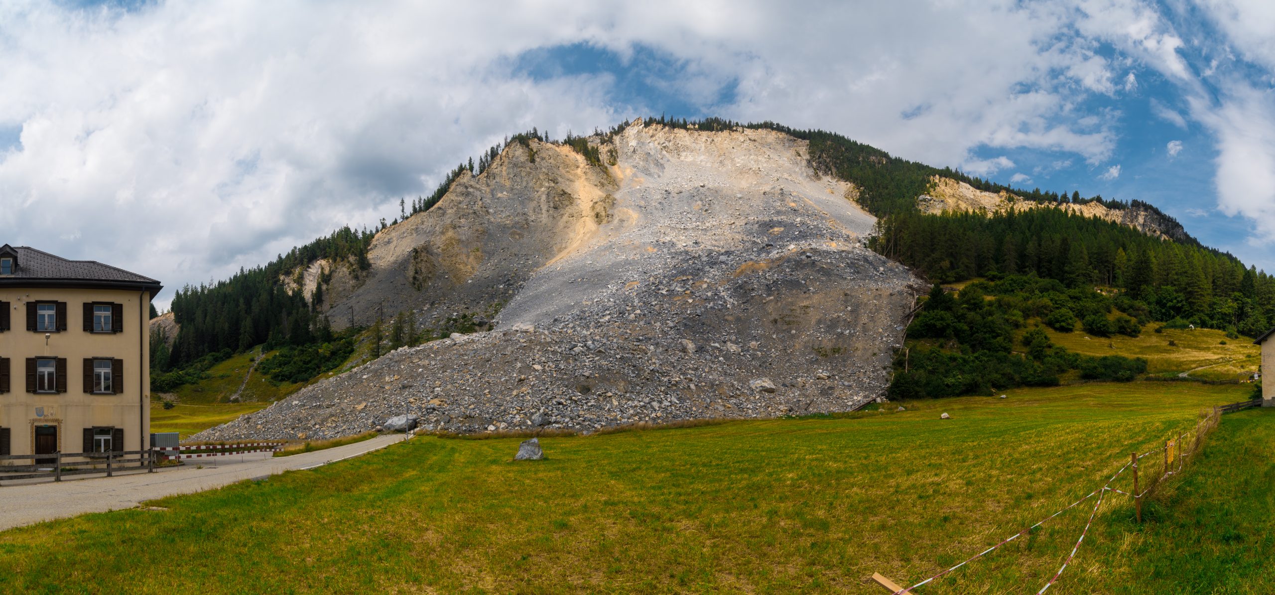
Recording of the situation after the rockfall in June 2023. The rockfall stopped just before reaching the school building.
In November 2024, the village had to be evacuated again because another rockfall of similar magnitude threatened the debris field above it. Since then, the area has been closed to the public. The monitoring systems remain in operation and provide continuous updates on the stability of the slope. As the Rhaetian Railway line would also be affected in the event of a major incident, the rockfall radar was connected to the RhB traffic lights at the end of 2024. This means that trains can be stopped immediately if a rockfall event reaches a predefined zone.
GEOPREVENT’s monitoring systems played a key role in enabling evacuation decisions to be made in good time, protecting the population and preventing loss of life and damage to infrastructure. Continuous monitoring of the area will remain crucial in the future in order to be able to respond quickly and appropriately to any further changes in the slope.
More information
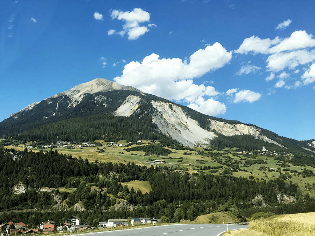
The rockfall zone behind the village of Brienz.
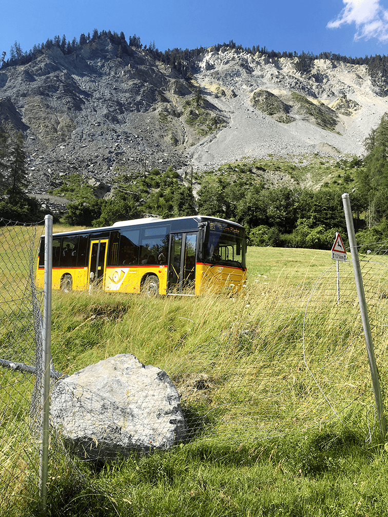
Rock boulders reach or cross the road outside the village regularly.
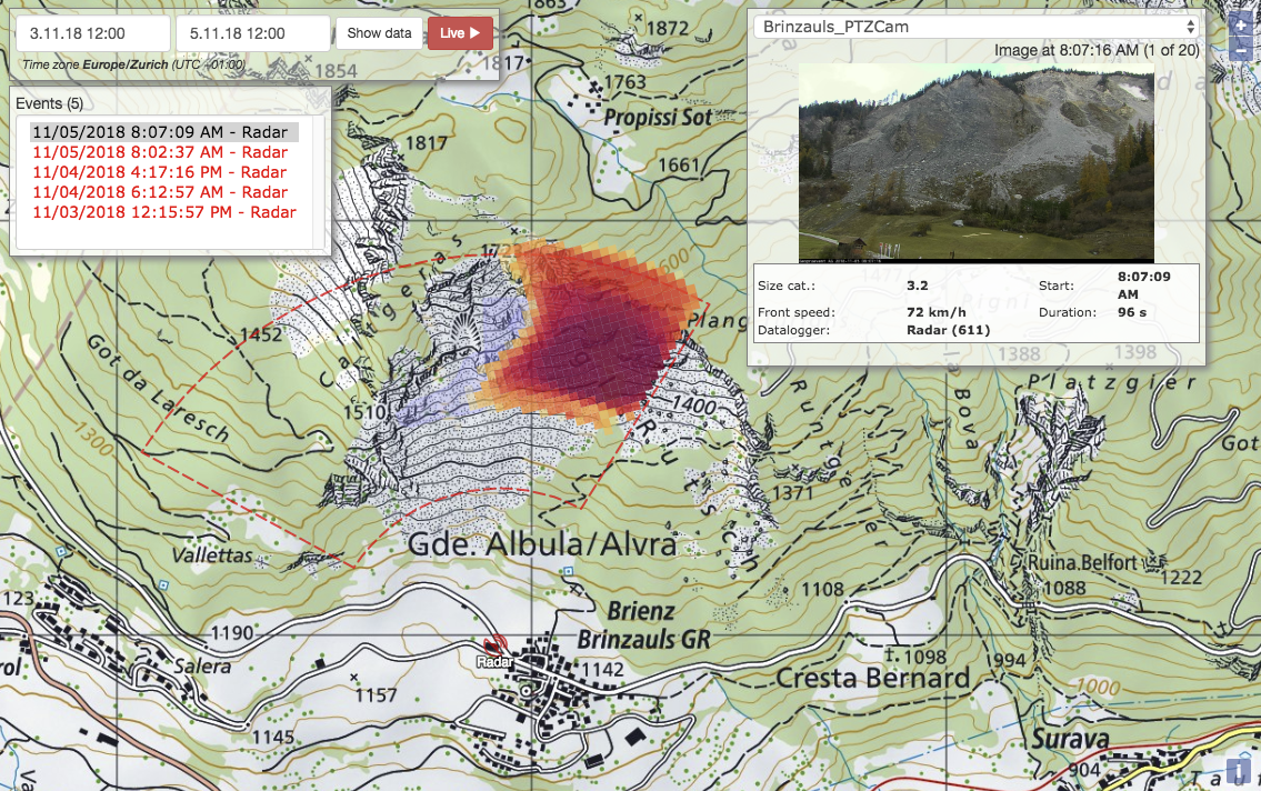
Online data portal: Rockfall map of the selected time period and corresponding image series of the integrated webcam.
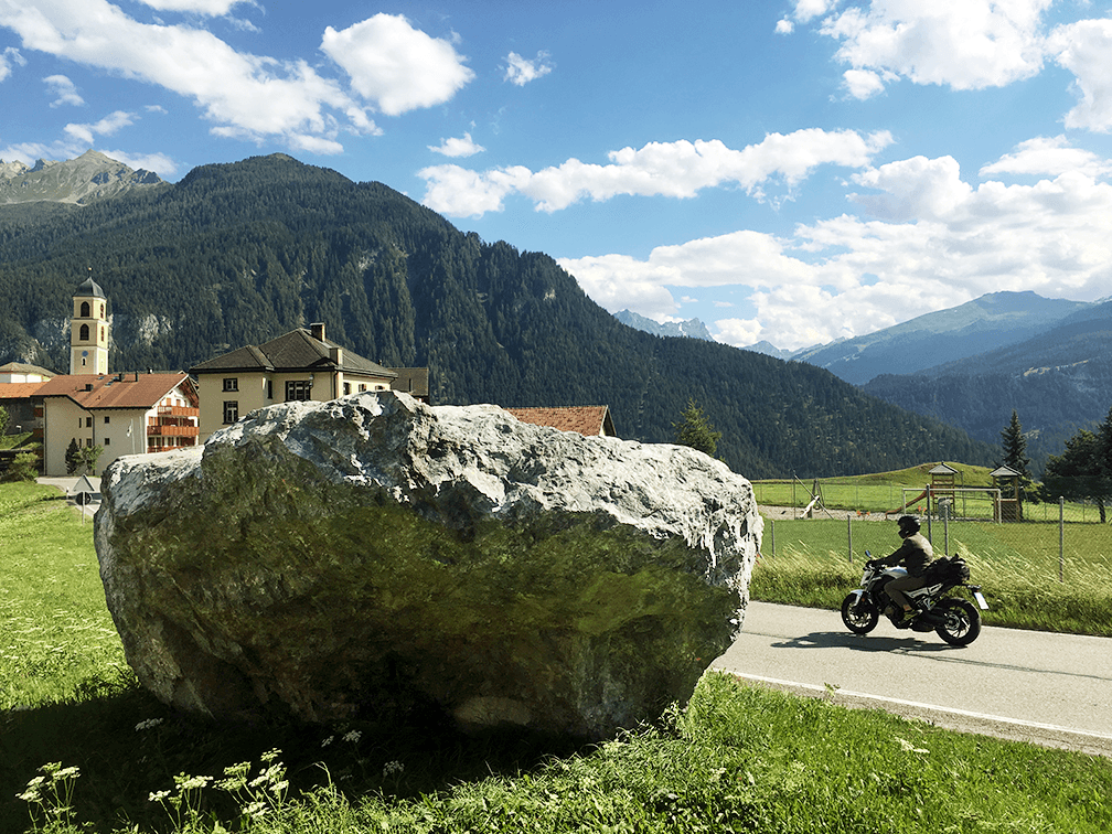
This big boulder stopped just before the road.
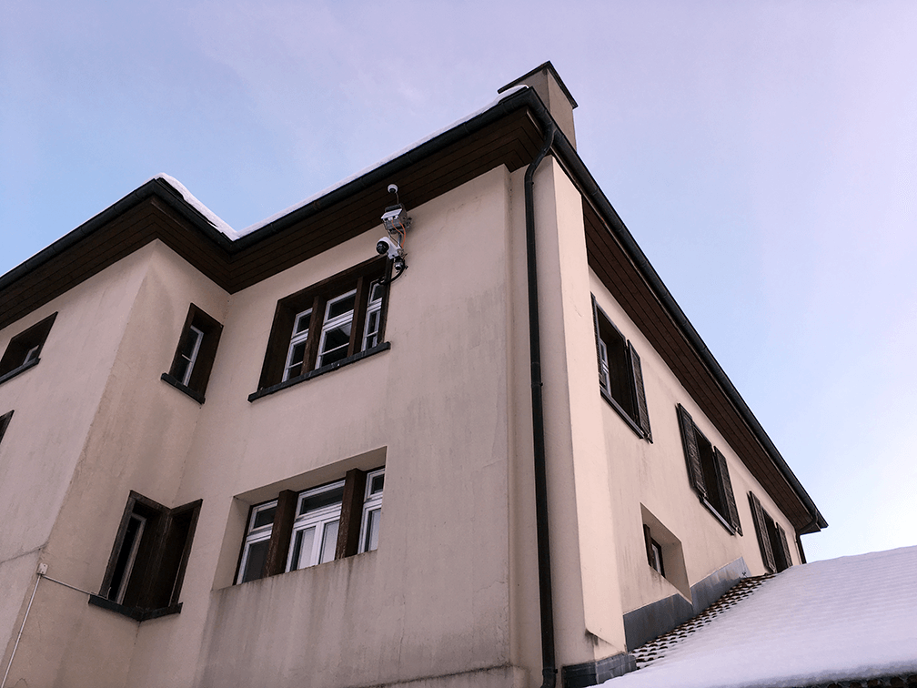
The Rockfall Radar is installed at the former school building of Brienz.
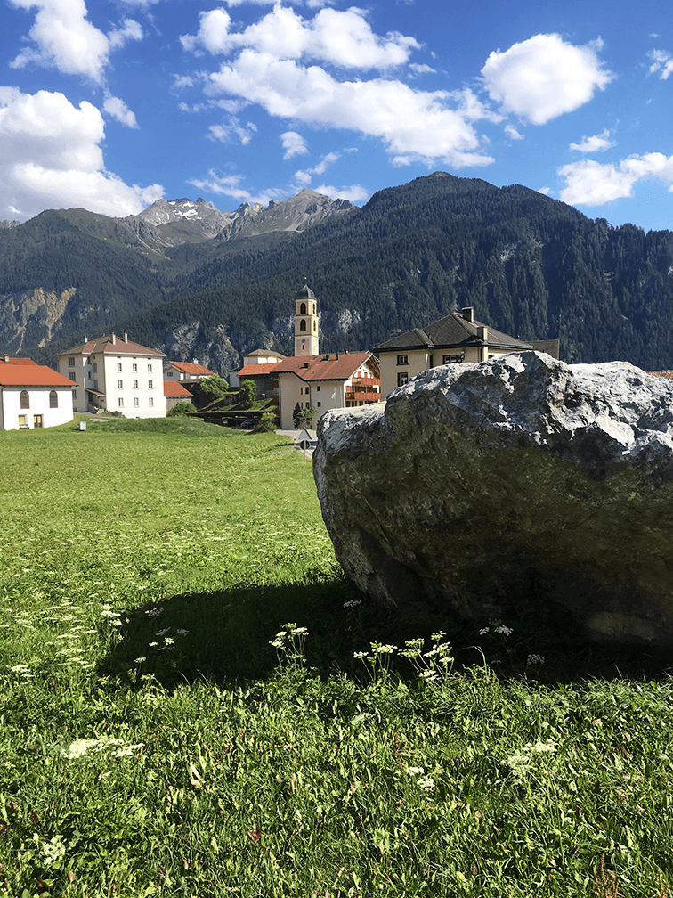
The village of Brienz with the church which tilted as a result of the landslide.
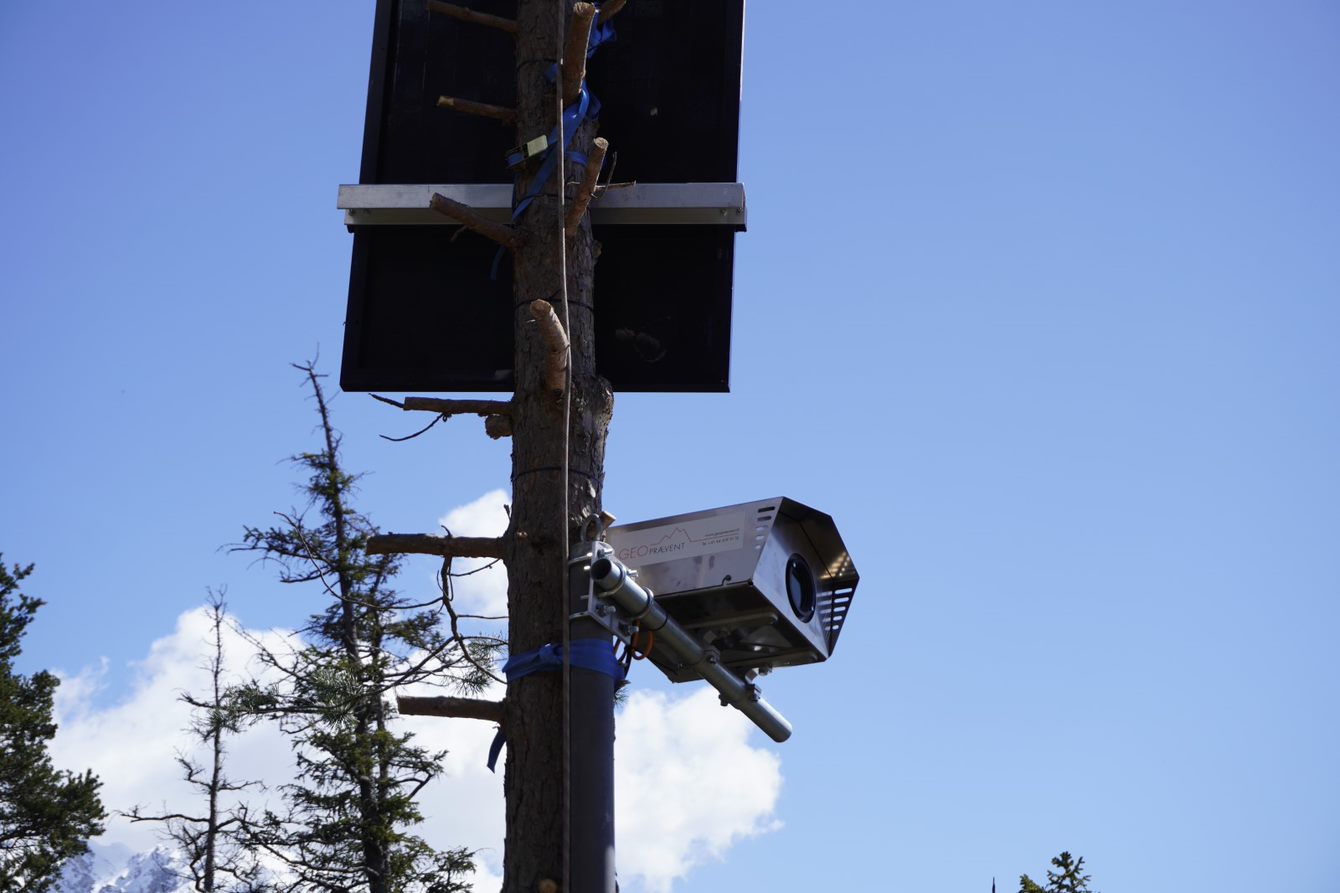
Deformation camera
Customer
Civil Engineering Office
Canton of Grisons