Rockfall radar Brienz
Challenge
The Swiss village of Brienz is located on a sunny slope of the Albula valley amidst a large landslide area. The entire slope including village has been sliding very slowly downhill for many years, but in recent years the slide velocity has increased significantly. Ground movements of up to 70 cm per year are currently observed in certain areas. As a result, some building walls show cracks and roads require frequent repair. On the north side of the village is a rockfall zone that is linked to the landslide. Rock boulders frequently detach there and occasionally reach the main road outside the village. Several rockfall protection dams have been built over the years. They are unable to provide complete protection though as some boulders still pass the dams and endanger the road. The village itself is not directly affected by these rockfall events.
Solution
The Rockfall Radar detects falling boulders in real time and automatically closes transport routes at risk. Since the road passes through the runout zone of the rockfall zone in Brienz, it takes between 30 and 60 seconds for a boulder to reach the road depending on boulder size and track. This warning time is sufficient to close the road in time. The Rockfall Radar functions independently of prevailing visibility conditions, day/night as well as in fog or snow. The Rockfall Radar is mounted to the wall of the former school in Brienz and permanently monitors the rockfall zone at a distance of approx. 1 km. Upon rockfall detection the radar automatically switches the traffic lights to red and notifies the responsible safety managers. Should a vehicle be within the closed area when the alarm is triggered, there is enough time to leave the road section at risk assuming normal travel speed.
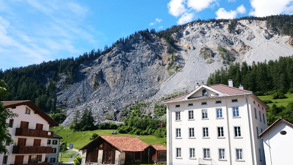
The rockfall zone behind the village with the road section at risk in the background.
Once the radar has detected rockfall, it tracks the course of the boulders until they stop or move out of the radar’s field of vision. In addition, the Rockfall Radar activates the system-integrated webcam allowing automatic recording of the event. Authorised users can access all event data at any time using the online data portal via PC, tablet or smartphone. The rockfall event is displayed on a map including corresponding event images and key parameters (e.g. duration and speed). The camera further offers live views of the area at any time and allows for detailed event analysis using the remote zoom, pan and tilt functions provided the visibility conditions are good.
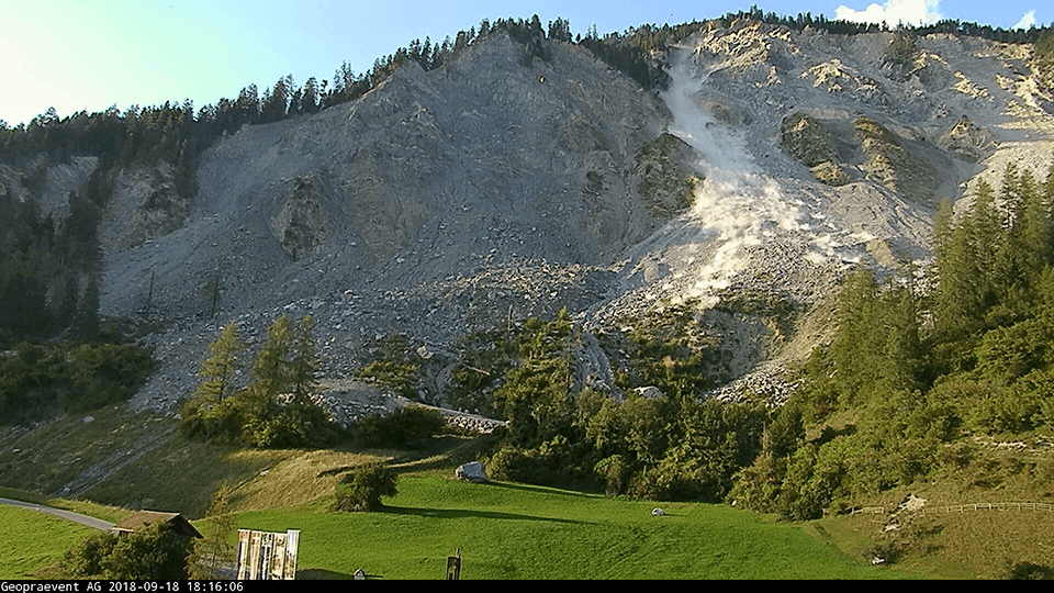
Detected rockfall recorded with the integrated camera.
Following a prolonged test phase, automatic closure of the exposed road section went into operation in mid-December 2018. The alarm system is also linked to the operations control centre of the Civil Engineering Office of the Canton of Grisons (BLZ TBA GR). Since initial installation of the Rockfall Radar, more than 1000 events with boulders of various sizes have been detected. However, only a few of these boulders reached as far as the road or even crossed it. To avoid unnecessary closures, we defined a danger area within the rockfall zone where the detection of rockfall triggers a road closure. Rockfall events outside this area are remain without immediate action. In addition, we implemented automatic reopening of the road: as soon as the danger is over, the system gives the all-clear and reopens the road.
More information
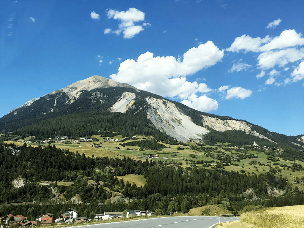
The rockfall zone behind the village of Brienz.
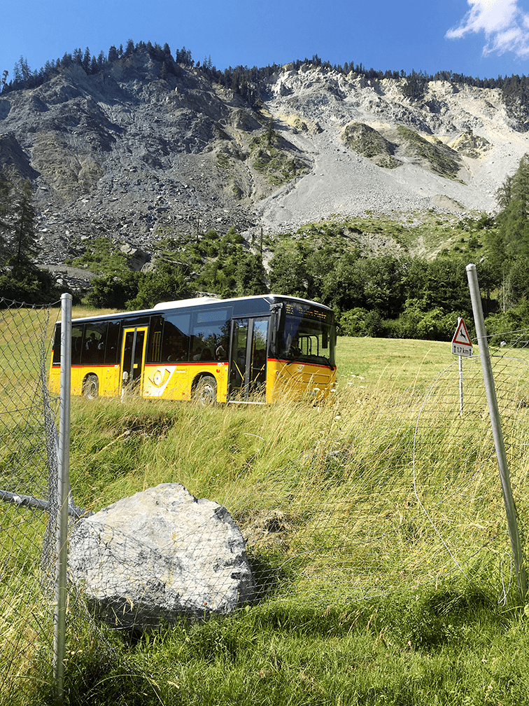
Rock boulders reach or cross the road outside the village regularly.
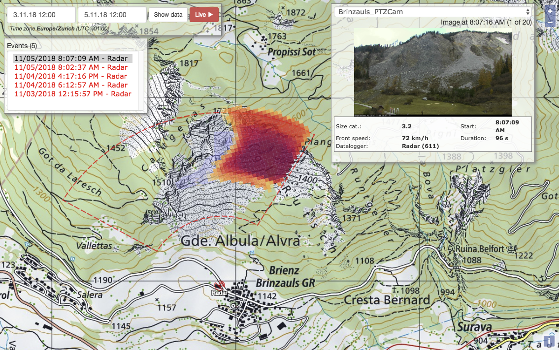
Online data portal: Rockfall map of the selected time period and corresponding image series of the integrated webcam.
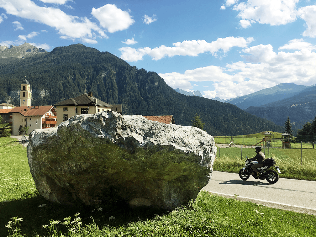
This big boulder stopped just before the road.
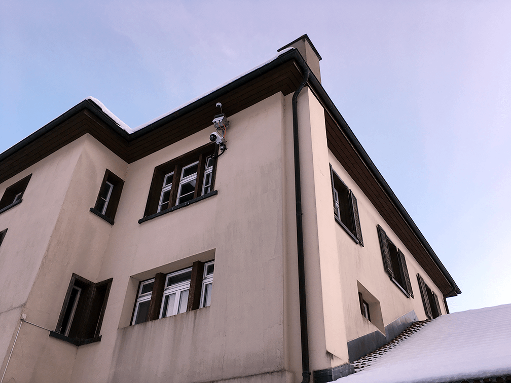
The Rockfall Radar is installed at the former school building of Brienz.
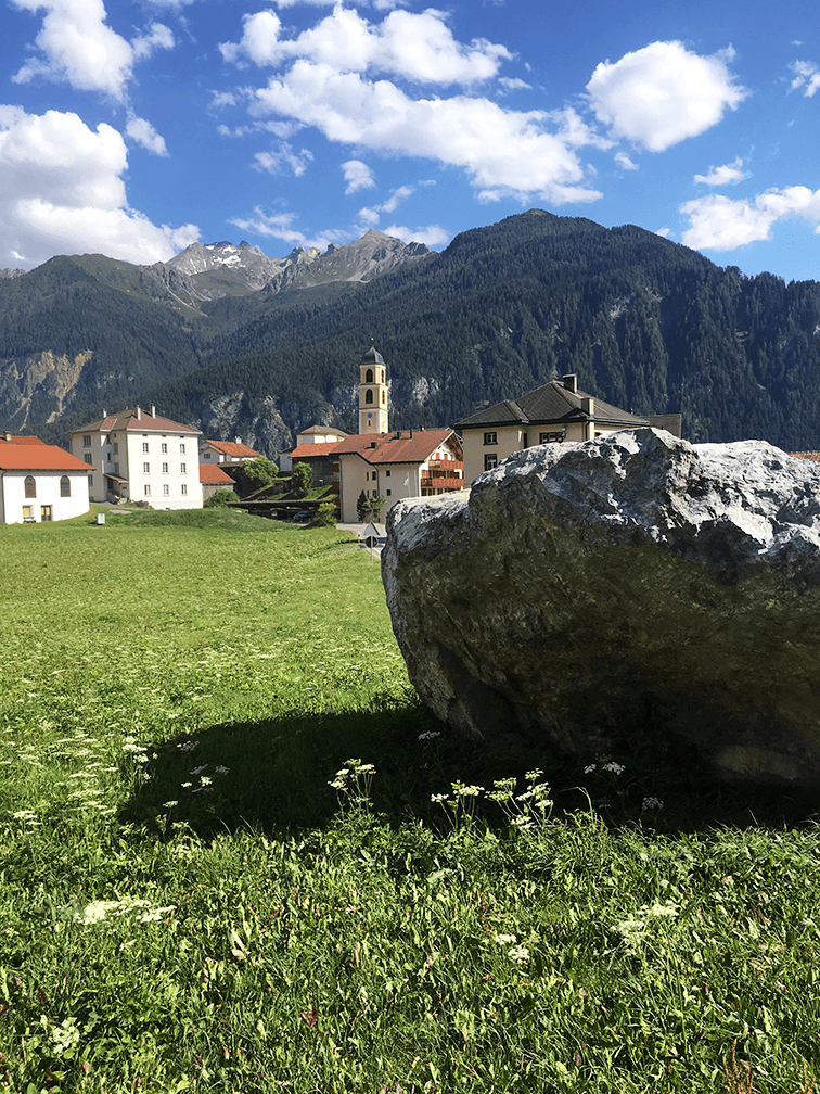
The village of Brienz with the church which tilted as a result of the landslide.
Location
Customer
Civil Engineering Office
Canton of Grisons
Technologies
Download