
AVYX® Avalanche Radar
Avalanche radar is the most reliable technology for automatically detecting avalanches and offers significant advantages over conventional, local sensors. Radar works in all weather conditions and at any time of day, has a range of up to 7 km, and can cover large avalanche slopes with a single device.
Learn more:
⇒ Benefits and features
⇒ Applications and reference projects
⇒ Technical data
⇒ Videos in the media
⇒ Brochure Avalanche radar
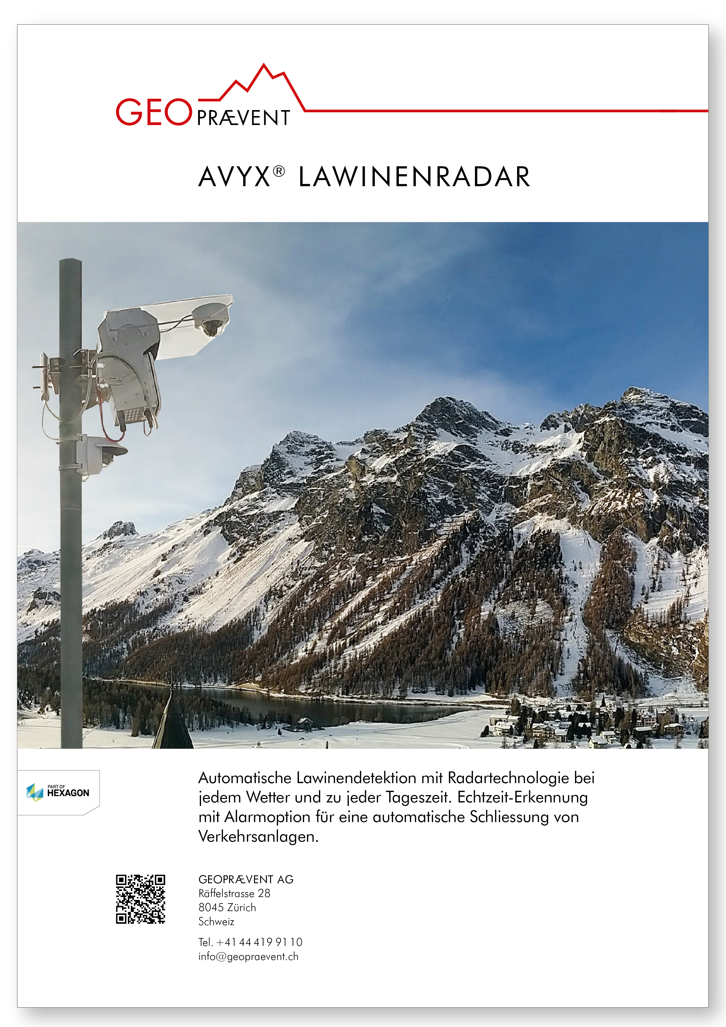
Advantages
- Reliable avalanche detection with a range of up to 7 km
- Monitoring of an area of up to (10 km²)
- Automatic triggering of alarm in the event of an avalanche (e.g., road closure)
- Separates different flow paths and shows them on an interactive map
- All-weather suitability (works in rain, fog, snowfall) as well as day and night
- Avalanche tracking and mapping on a map of the surrounding area, including avalanche characteristics
- Quick installation (few hours)
- Cost-effective compared to construction measures
- Access to all data at any time via the GRAVX online data portal
- Integration with smartphone and tablet
- easy to combine with other technologies and alarm-functions
Applications
The avalanche radar is designed to provide an early warning of avalanches and to trigger an alarm. In the event of an avalanche, roads and railway lines are automatically closed within seconds and people in the danger area are reliably alerted. The avalanche radar is also applied for avalanche control works to verify the success of an artificially triggered avalanche. Without radar, this is particularly challenging in darkness or bad weather conditions (fog, snow, rain).
A statistical evaluation of the avalanche detections in winter 2017/18 by the avalanche radar in Zermatt showed that more than 80% of the avalanches occurred in poor or no visibility. Click here for the avalanche radar infographics!
A similar radar system can also be used for the detection of rockfall or debris flows and for the detection of people in areas at risk, e.g. associated with artificial avalanche triggering.
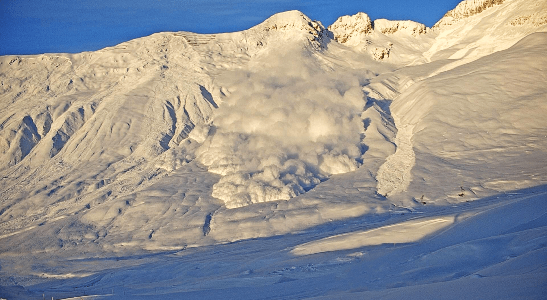
The avalanche radar reliably detects avalanches in any weather and at any time of day.
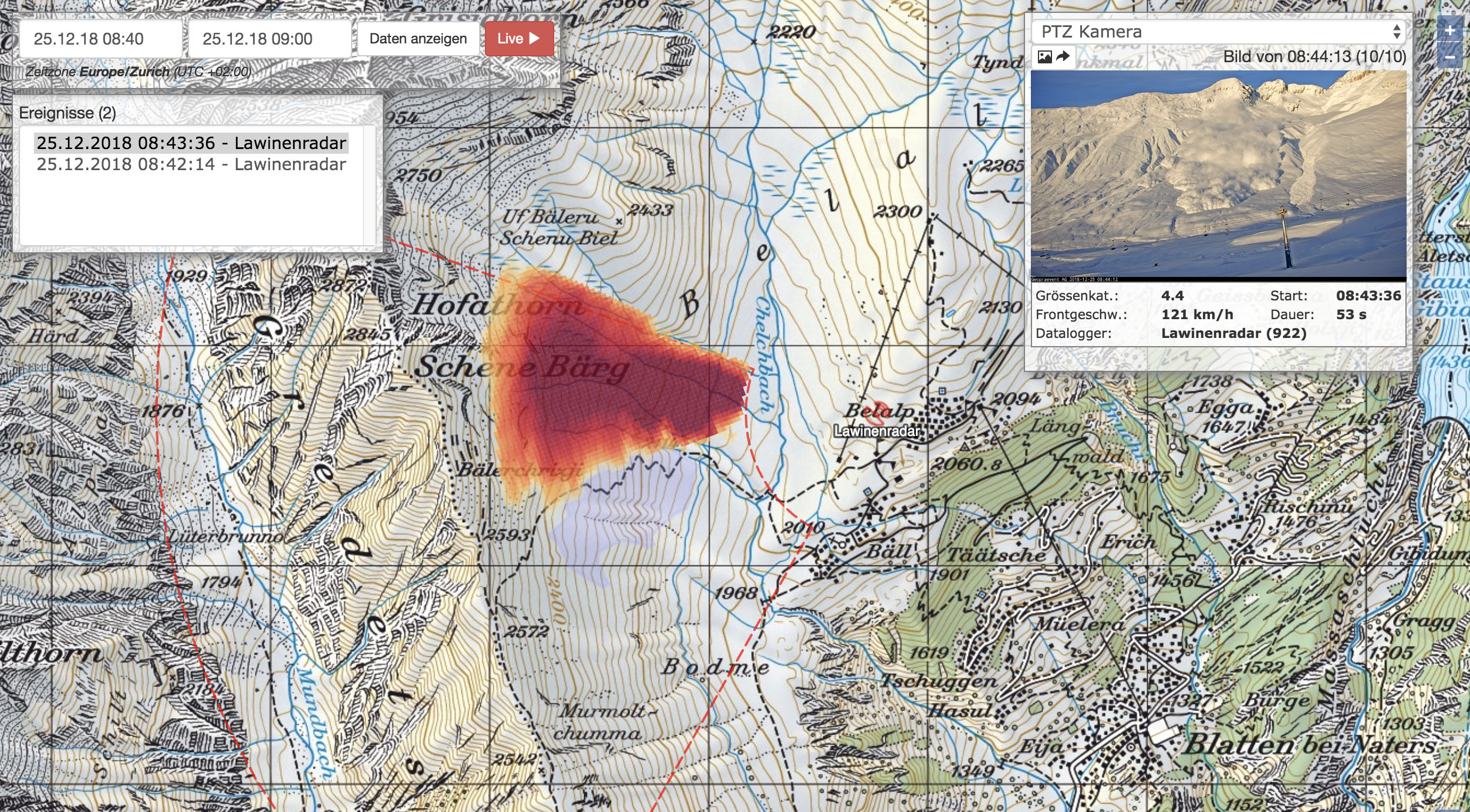
The online data portal displays the avalanche on an area map along with the measured characteristics and a photo series.
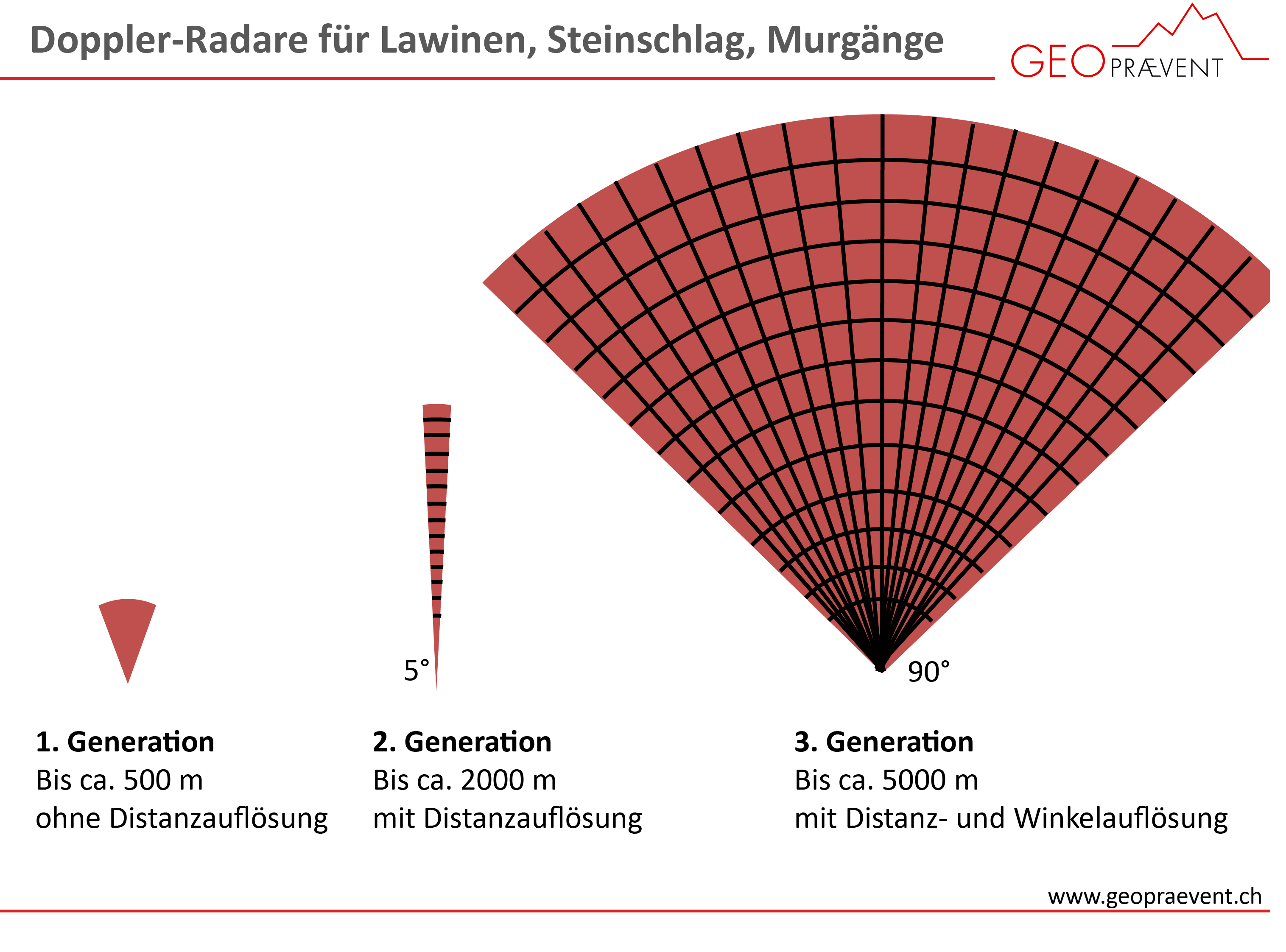
Our 3rd generation avalanche radar covers an area of up to 10 km².
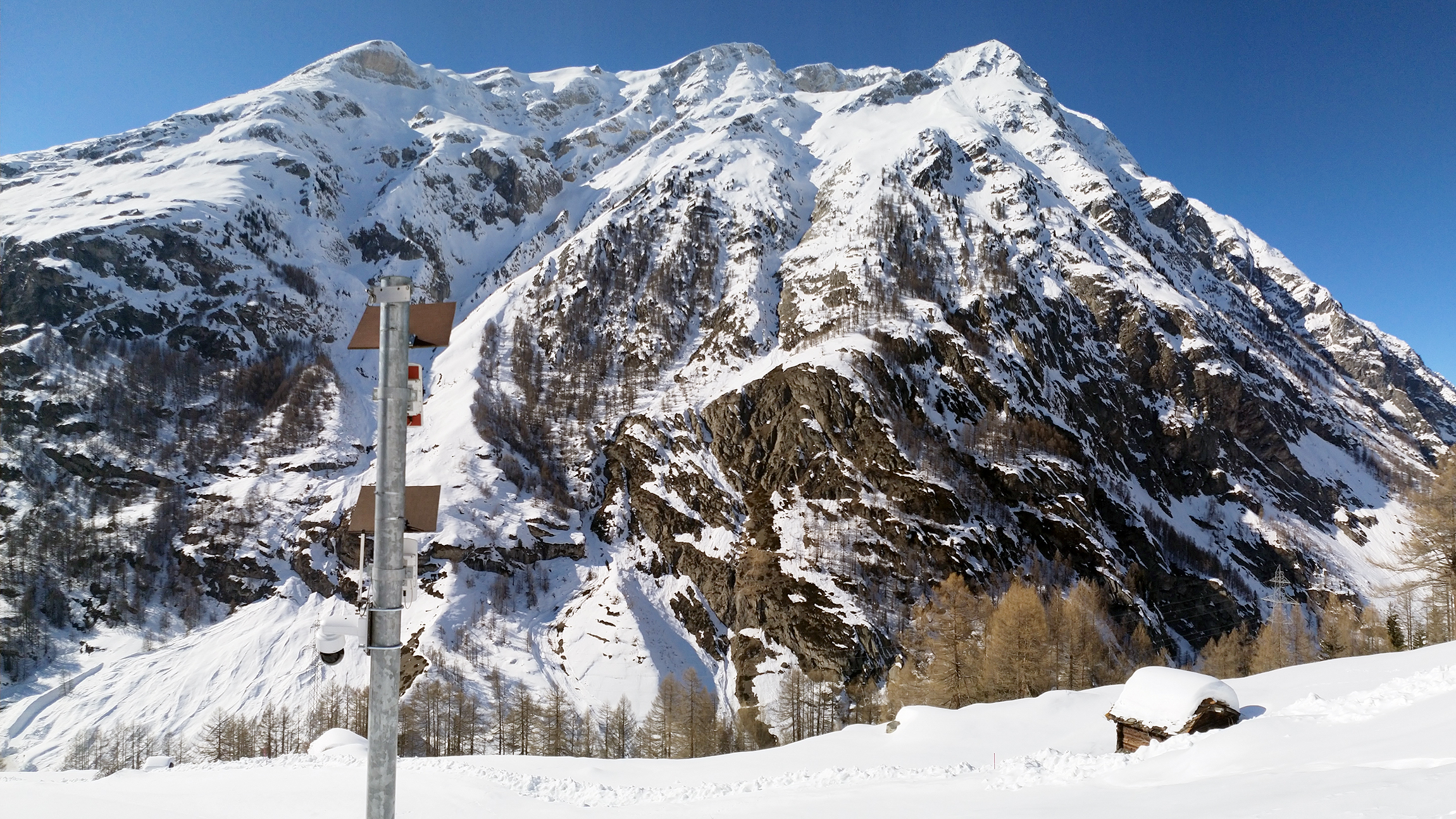
The avalanche radar system in Zermatt monitors two avalanche paths and automatically closes the access road.
Reference projects
To date, we have implemented more than 40 avalanche radar projects on three continents. We currently operate over 20 avalanche radar systems in Switzerland, Norway, Chile and Canada.
Here is a selection of avalanche radar customer projects:
Additional technologies
The following technologies are often combined with the avalanche radar:
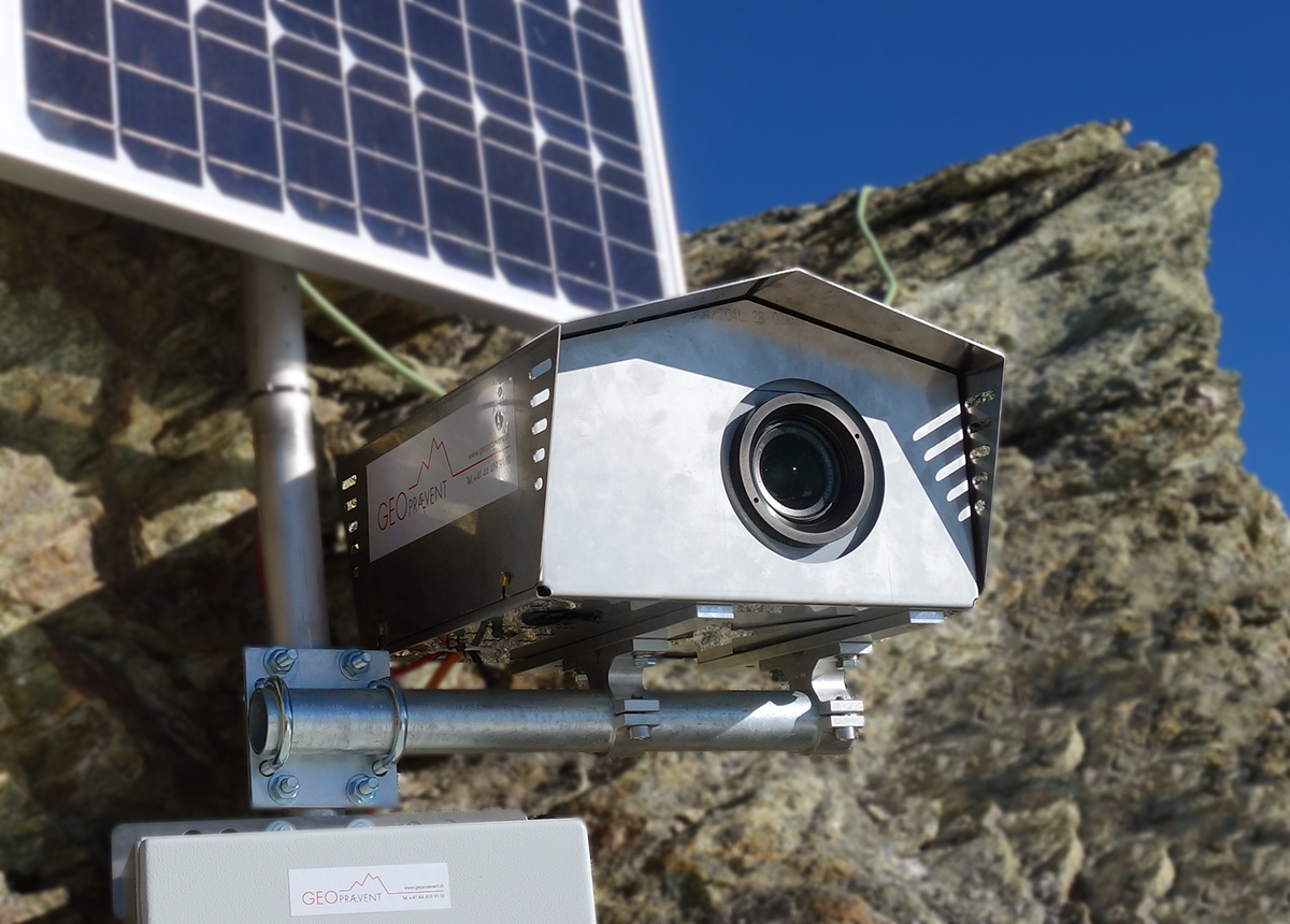
Technical data
- Reichweite: bis zu 5 km
- Area: up to 10 km²
- Opening angle horizontal: 90°
- Opening angle vertical: 20°
- Weight (without mast): approx. 50 kg
- Dimensions: 25 x 40 x 7 cm
- Energy consumption: approx. 50 W
- Power supply: grid power, solar panel, fuel cell
- Software: avalanche-detection-algorithm, online data portal
- Integration: online data portal, smartphone, tablet
- Alarm: automatic alert option, other alarm-functions
- Installation: quick, few hours
A radar module with a shorter range and smaller monitoring area is also available.
Scientific publications
in english
- Avalanche warning and glacier monitoring system in Randa, ISSW 2018 extended abstract
- Avalanche detection for road safety in Norway (Holmbuktura), ISSW 2018 extended abstract
- Automatic People Detection System Zermatt, ISSW 2018 extended abstract
- Real-time avalanche detection, ISSW 2016 extended abstract
- Radar-based Warning and Alarm Systems for Alpine Mass Movements, Interpraevent 2016 extended abstract